HOUSTON — It's April in the Great Plains and you know what that means: severe weather season.
However, not all severe weather outbreaks are created equal. Three main ingredients are needed for severe thunderstorms to develop: energy, wind shear, and lift.
Lift is the one ingredient that can come in a variety of different forms.
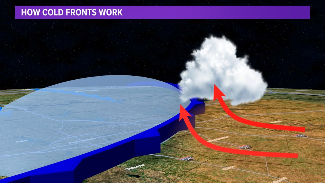
Typically, cold fronts are the main culprit for providing lift in the atmosphere. In that setup, cold dense air undercuts warm and humid air causing it to rise. As a result, rain and storms develop, becoming severe if the other ingredients are present.
However, cold fronts aren't the only forcing mechanisms that provide lift.

Another, which is unique to the Plains, is known as a dryline.
Simply stated, a dryline is a boundary that separates arid, desert air from humid, tropical air. Along the dryline, the dry dense airmass undercuts the humid airmass forcing clouds to grow and storms to form.

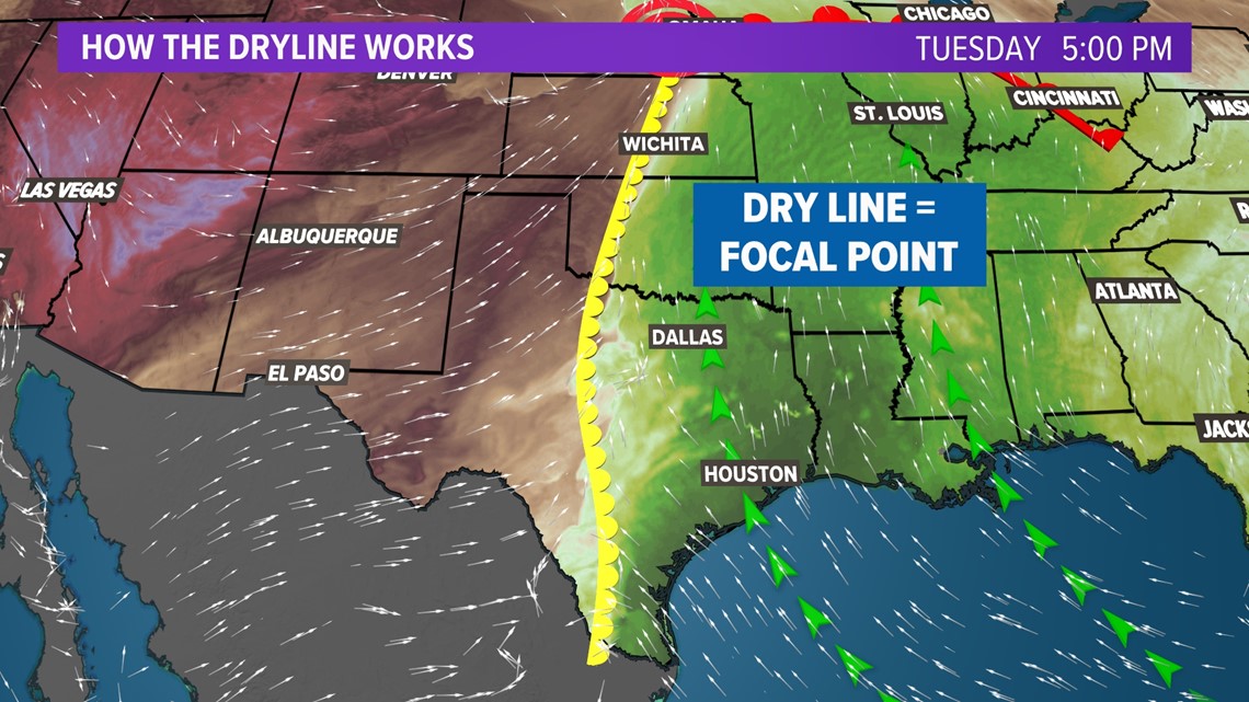
The reason why drylines are unique to this part of the U.S. has to do with geography.
To the west, expansive deserts become a breeding ground for dry airmasses; to the east, the Gulf of Mexico acts as a reservoir for humidity. When these two air masses clash, the result can be explosive thunderstorms producing everything from large hail to tornadoes.