HOUSTON — This page will no longer be updated. You can read the latest forecast here.
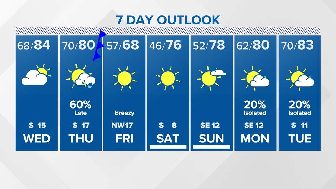
7-Day Forecast

Follow the KHOU 11 Weather Team for the latest updates on the forecast:


HOUSTON — This page will no longer be updated. You can read the latest forecast here.
Follow the KHOU 11 Weather Team for the latest updates on the forecast: