
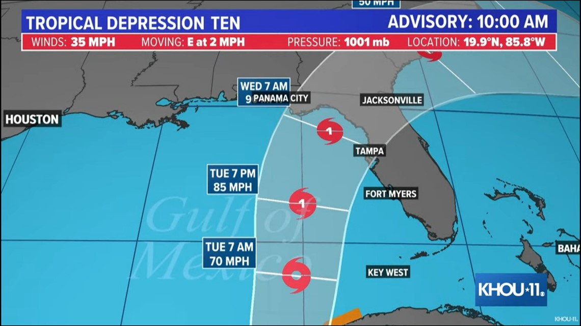
HOUSTON — The area of low pressure that we've been watching near the Yucatan Peninsula was designated as Tropical Depression 10 (TD 10) today and is expected to become a hurricane later this week. TD 10 will remain nearly stationary over the next 36 hours before starting its movement to the north, into the Gulf of Mexico. From there, hurricane strength is expected before landfall sometime midweek.

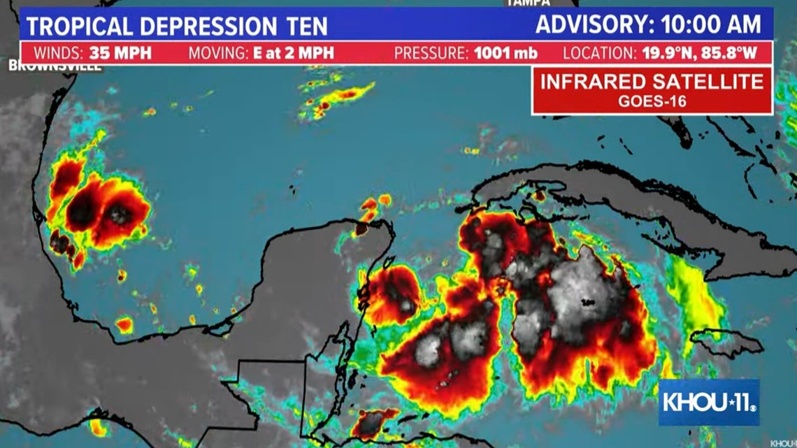
Even though the Texas coast isn't expecting any impacts from this moisture source (would be nice, we need the rain) we will be providing updates through the weekend. This time of year things can rapidly change.

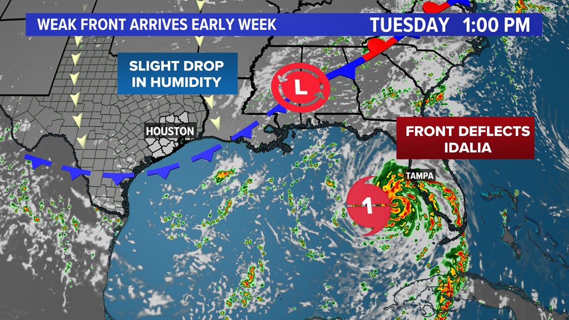
At this point, it could cross the Yucatan or stay in the open warm waters of the gulf which would support development. The reason we won't see anything from this is that we have a weak front on the way. This boundary will help as an upper-level steering current and push the moisture and any development to our east. That will hug the Florida coastline around Tuesday/Wednesday next week.

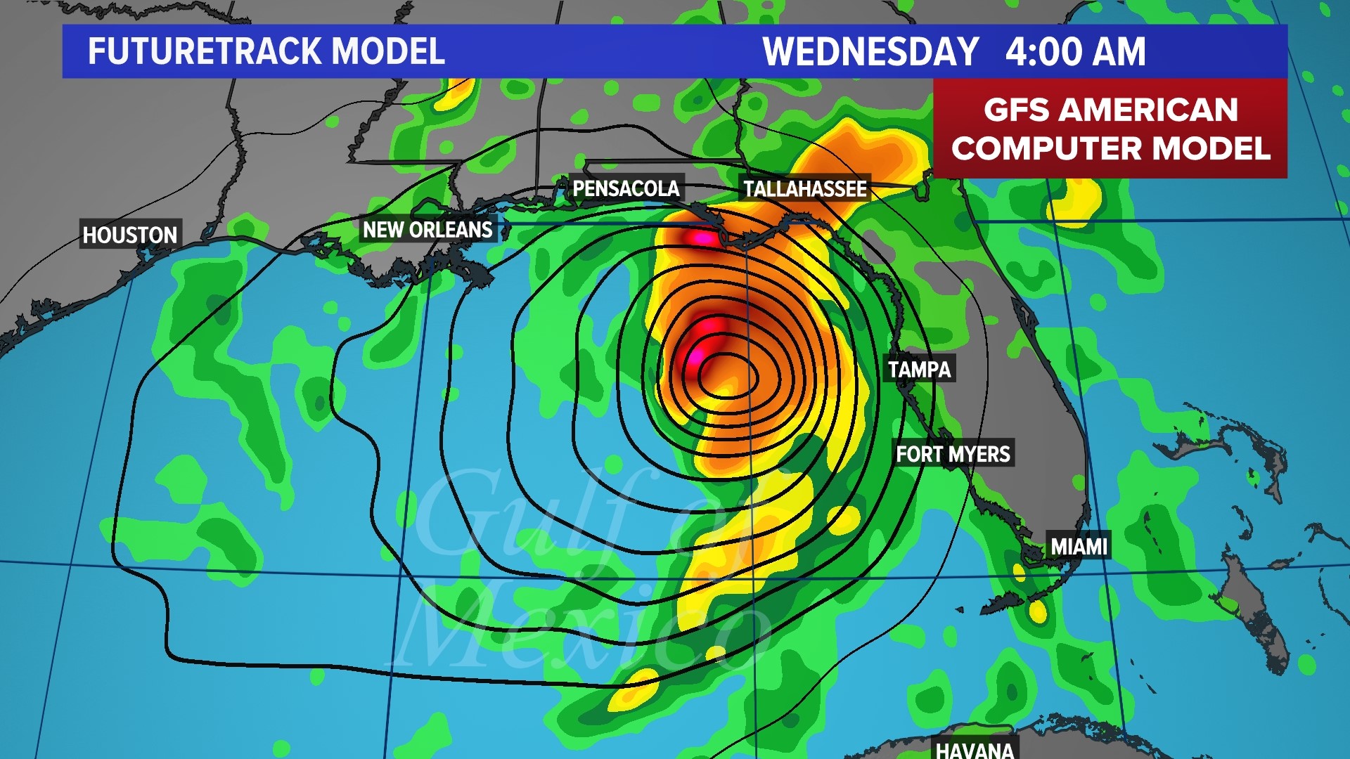
As of Saturday evening, the European and American models had come into better agreement on timing and intensity for TD 10. Both bring the storm up the Florida West Coast by midweek, with landfall as a hurricane sometime late Tuesday or early Wednesday. That being said, significant uncertainty still remains regarding the intensity and exact location of landfall.

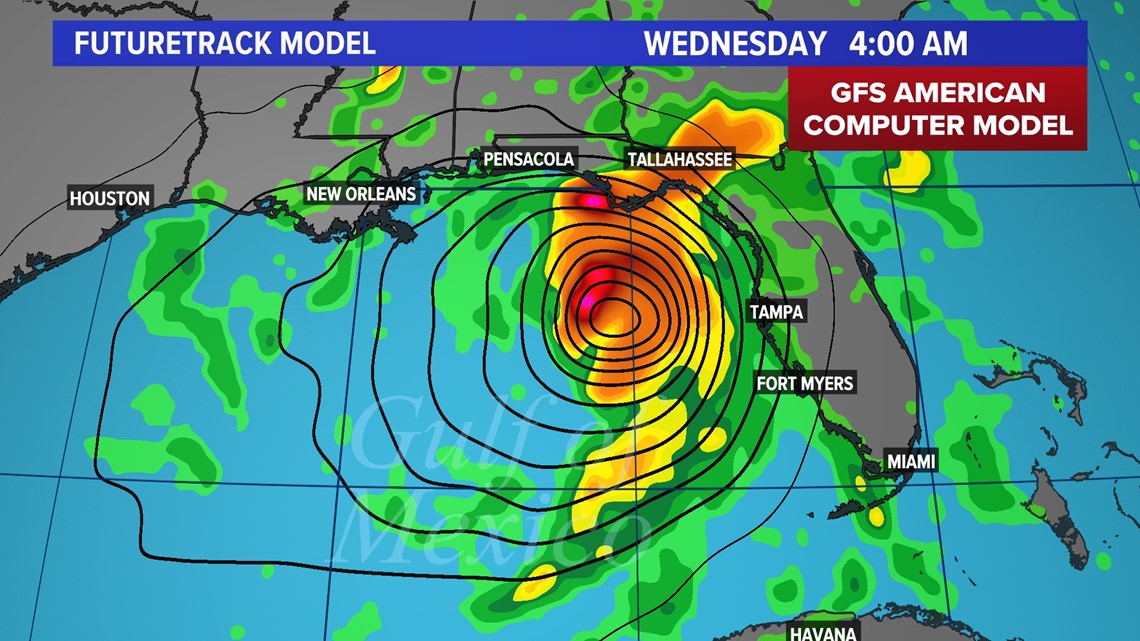

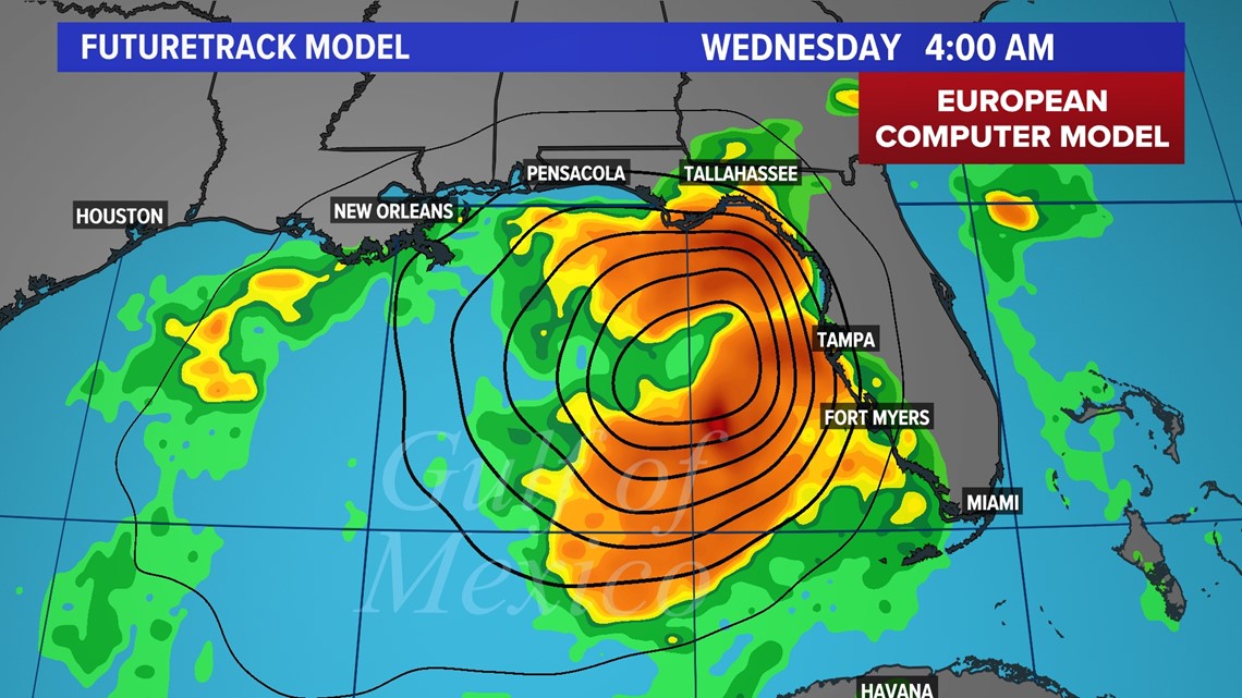
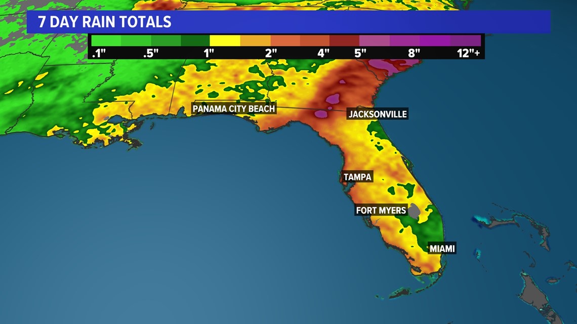
Regardless of specific details, storm surge and heavy rain will be widespread impacts felt from Naples all the towards the Big Bend of the state. On average, Florida could see anywhere from 2-5 inches of rain with the areas near landfall seeing as much as a foot.

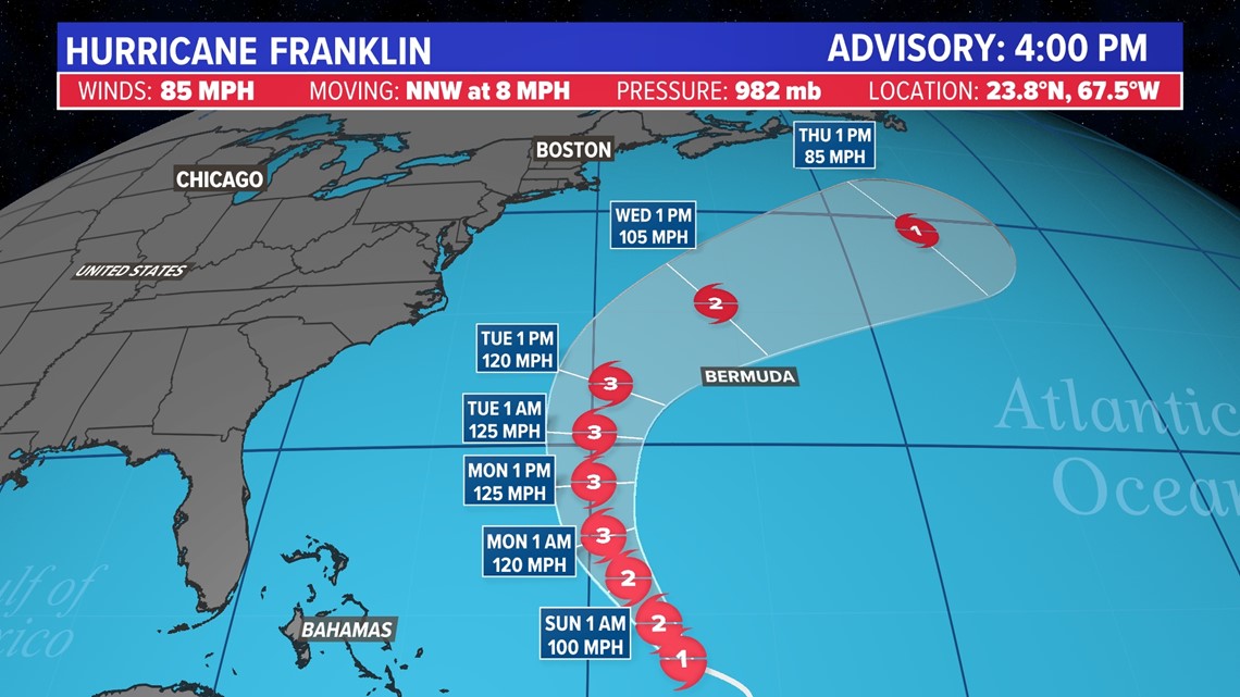
Aside from TD 10, Hurricane Franklin is expected to gain strength as it moves north in the Atlantic. By Monday, the storm is expected to reach major category 3 hurricane strength. Fortunately, the current forecast track takes this storm away from land.

2023 Atlantic hurricane season predictions
The National Oceanic and Atmospheric Administration recently doubled the chances of a nasty Atlantic hurricane season this summer and fall.
The agency said there's a 60% chance for an above-normal hurricane season, twice the agency's May forecast which said it was 30%. The earlier forecast leaned more toward a near-normal season with a 40%, but the chance for normal has now shrunk to 25%.
Although the NOAA outlook doesn’t forecast storm tracks or what places will get hit, a busy season like the one forecast means “there is a doubling of the chance of a hurricane making landfall on the East Coast of the U.S.,” said Matthew Rosencrans, lead hurricane season forecaster with NOAA’s Climate Prediction Center.
NOAA is now forecasting between 14 to 21 named storms, which is an increase over forecasters' initial May forecast of 12 to 17. A normal year has 14 named storms.
Of those named storms, NOAA predicts six to 11 will become hurricanes, which is more than the five to nine predicted in May. Normal is seven hurricanes. Of those hurricanes, NOAA predicts two to five will become major hurricanes with winds of more than 110 mph, which is one more than earlier predictions. A normal year sees three major hurricanes.
Follow the KHOU 11 Weather Team to stay up-to-date on the local forecast and what's brewing in the tropics: