HOUSTON — With more rain in the forecast, we're monitoring certain areas in Southeast Texas that could be hard hit again with flooding.
There is a way for you to track those spots, as well, using the Harris County Flood Control District's interactive map.
It's important to note -- the screen grabs below are NOT current. To see current levels and statuses, you need to check the Harris County Flood Control District's map. You can get there by checking this link.
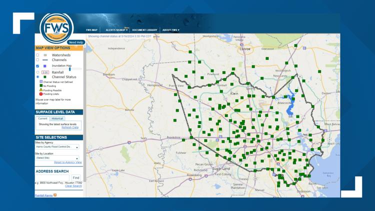
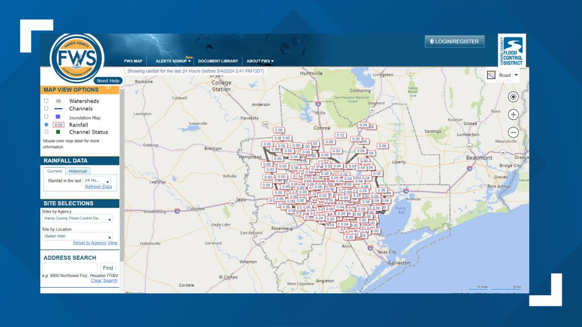
From there, you'll see a map with several checkboxes on the left. When you first get to the map, it'll show you an explainer of how to use it, then will default to a view of rainfall totals from the last 24 hours.

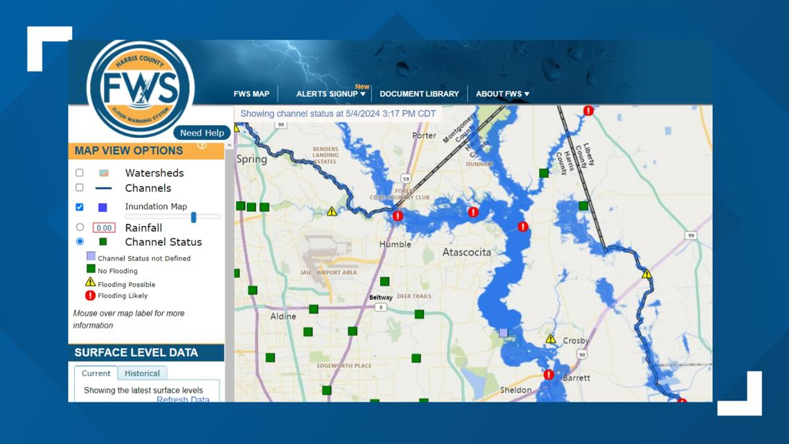
You can change that to 'Channel Status' and see areas that are likely to flood and those that flooding is possible. It'll also show areas with no flooding.


Here's a closer look at what you'll see. With each point on the map, you can click or hover to drill down for more information on each location.


There's also a feature to let you know where flooding is happening now. If you select the 'inundation' feature in the upper left, you can see with the slider bar how far outside the rivers and streams flooding is happening.

You can also sign up to receive alerts from HCFDC.
The state also monitors water levels, which is updated multiple times a day. You can monitor that here on the state's site.
The National Weather Service tracks these water levels multiple times a day and makes the information available online.