
HOUSTON — The KHOU 11 Weather Team is monitoring an 80 percent chance for rain and storms for your Wednesday that could impact your drive home from work or to the rodeo.
While strong storms are possible north of Houston, they shouldn't be as severe as the winds that caused damage in North Texas overnight.
RADAR: Track rain on one of dozens of local radars
GET ALERTS ON THE GO: Download the KHOU 11 app
TRAFFIC: Latest freeway incident reports across Houston
Here's what you can expect in Houston.
HOUSTON WEATHER TIMELINE:
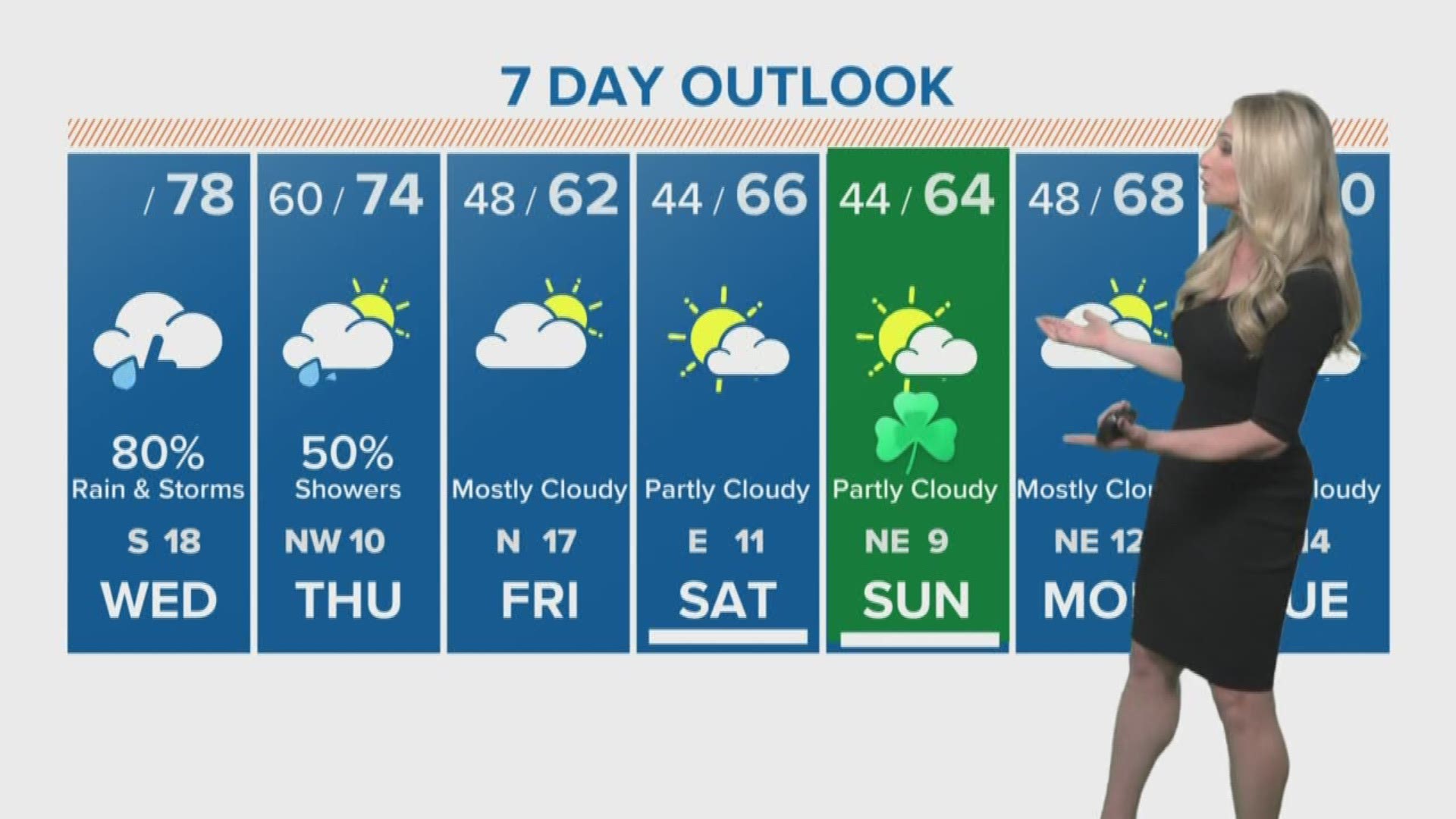
Wednesday - 80-percent chance for rain and isolated strong storms ahead of front the front starting around lunchtime and into the late afternoon. Storms and rain should clear by Wednesday evening. Strong storms are possible north of Houston from Brenham to Conroe.
Thursday - 50-percent chance for morning showers with temperatures in the 60s and 70s as cold front passes through.
(The rain is finally gone for a few days!)
Friday - Mostly cloudy, no rain chance. Temps cooler, in the 50s and 60s.
Saturday - Partly cloudy, temps in the 50s and 60s -- starting in the mid-40s in the morning, however.
Sunday - Partly cloudy, temps in the 50s and low 60s.
Monday - Mostly cloudy but still no chance for rain. Temps in the 50s and 60s,
ALSO POPULAR ON KHOU.COM: