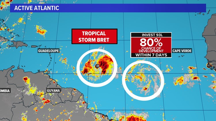
HOUSTON — The National Hurricane Center is monitoring two areas in the Tropical Atlantic this week, Tropical Storm Bret and another wave behind it that could become Cindy.
Tropical Storm Bret formed Monday and is expected to threaten the Lesser Antilles by late week. Behind it, a tropical wave is also becoming organized and has high odds of forming after today
The primary focus of course will be Tropical Storm Bret. This feature will struggle to strengthen a bit as it moves west in the coming days. However, the National Hurricane Center (NHC) forecast cone brings the storm into the Lesser Antilles as a strong tropical storm by Friday.


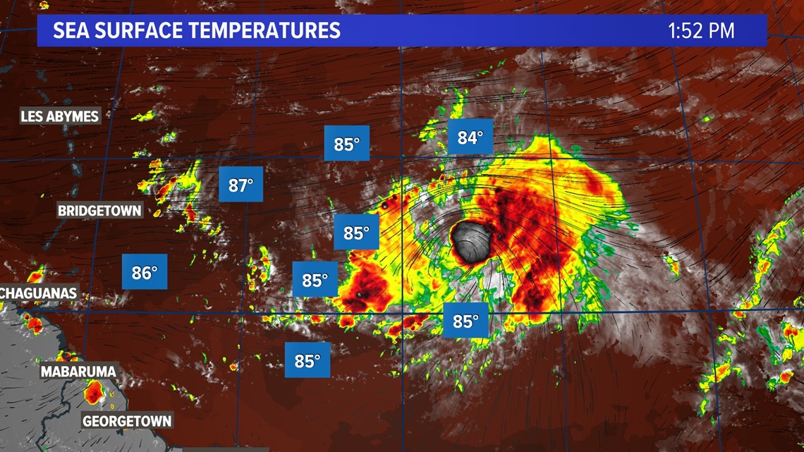
At the moment, Bret has very little standing in its way from organizing over the next few days. Water temperatures are more than sufficiently warm enough and wind shear is low. There's also an unusual lack of Saharan Dust in the atmosphere, which usually suppresses development this time of year.

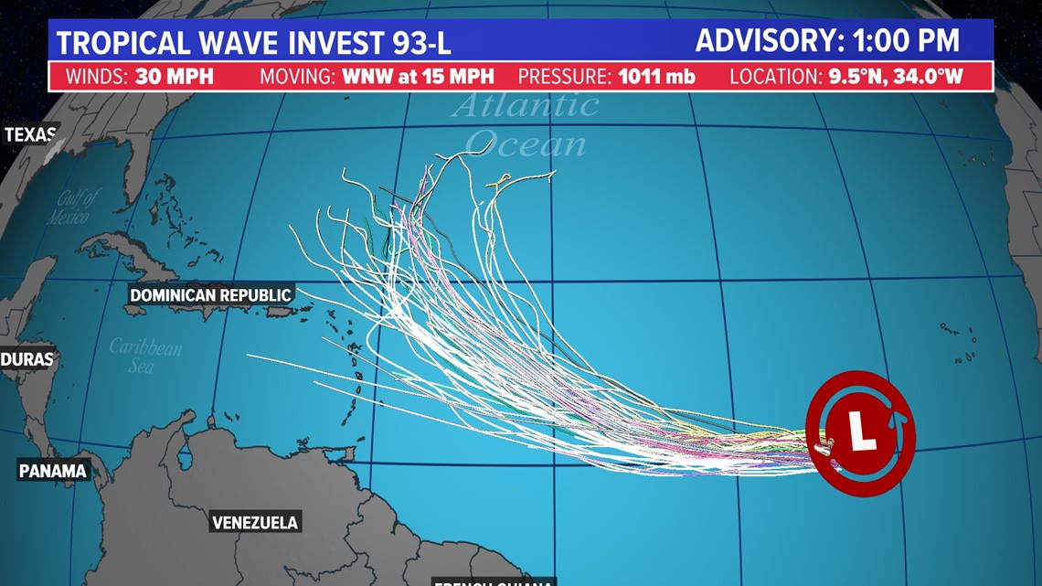
Behind Bret is another tropical wave tagged as Invest 93L. On satellite, the system looks healthy but may start to feel the influence of Bret, depending on how fast the latter develops.


Invest 93L now has high odds of developing by the end of the week. Organization will be heavily influenced by the evolution of Tropical Storm Bret. Either way, the next name on the list is Cindy, and if it forms, most models turn the storm north towards the Atlantic and away from land.

WHAT IS THE MAIN DEVELOPMENT REGION?
Tropical development in this part of the world is very common during August and September, the peak of Hurricane Season. For that reason, this area is known as the Main Development Region (MDR).


However, during the early part of the season, it is exceptionally rare to see any type of storm formation in the MDR because conditions are typically too hostile. Normally water temperatures are too cold, trade winds create too much shear, and Saharan Dust concentration is too high. However, this year, all of those factors are absent.


Water temperatures are running well above normal, with most readings around 80 to 85 degrees, sufficiently warm enough to support development. Additionally, trade winds are much weaker due to the absence of a strong Azores high, typical for this time of year. As a result, there is less wind shear and less Saharan Dust being transported across the MDR.