
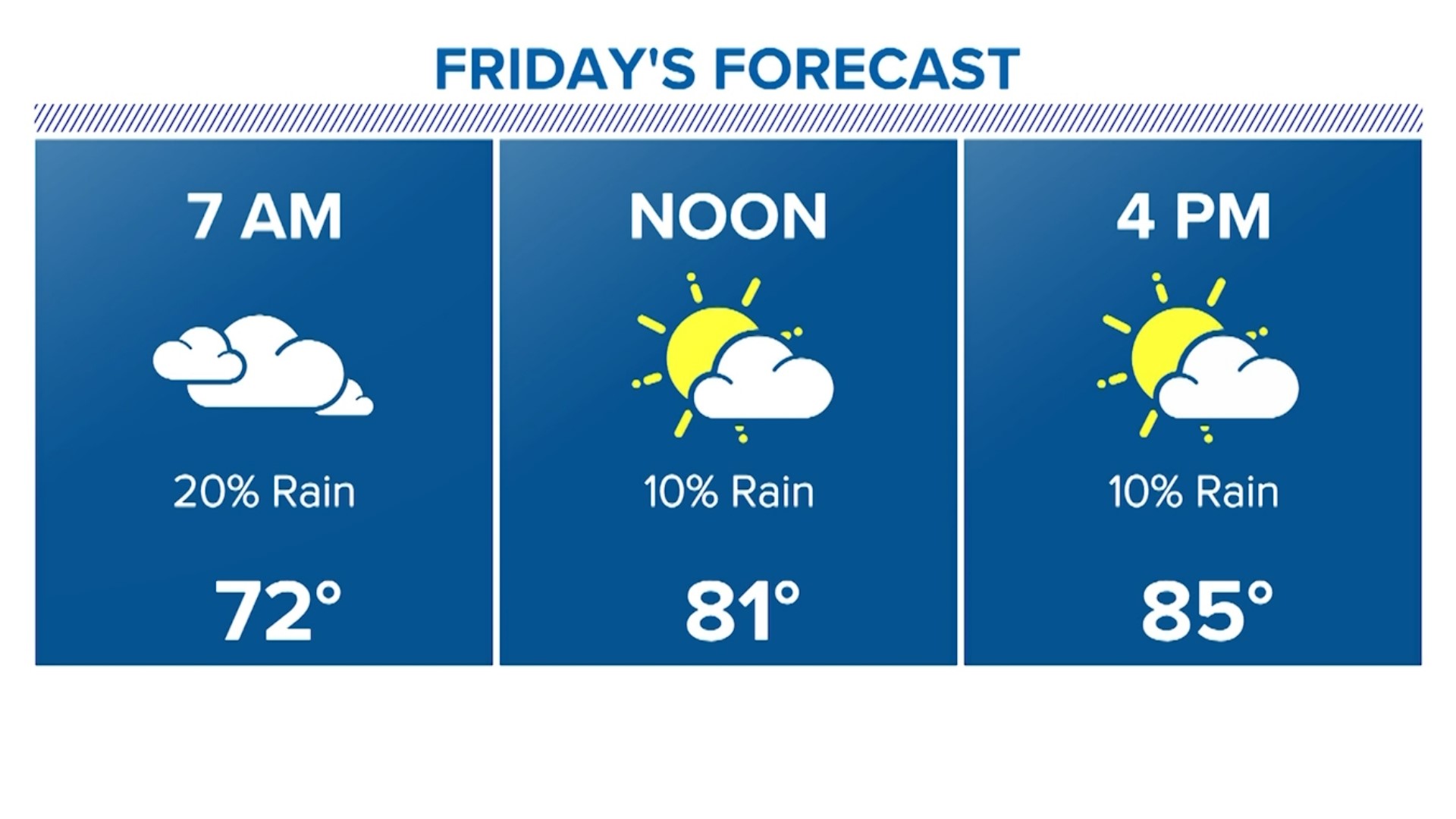
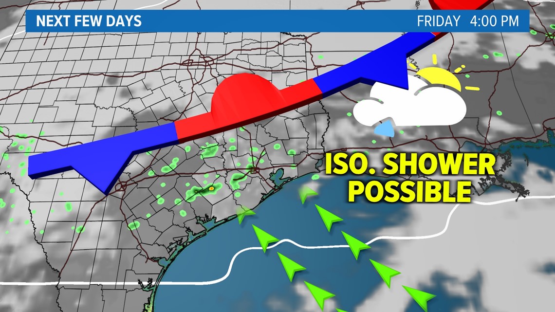
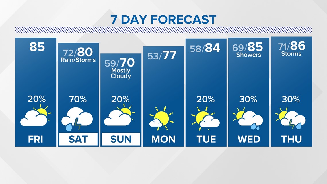
HOUSTON — Friday more clouds roll in again and we have a small chance of an isolated shower as the sea breeze works into the area during the afternoon. Highs still make it into the mid 80s. Don't expect much rain today.

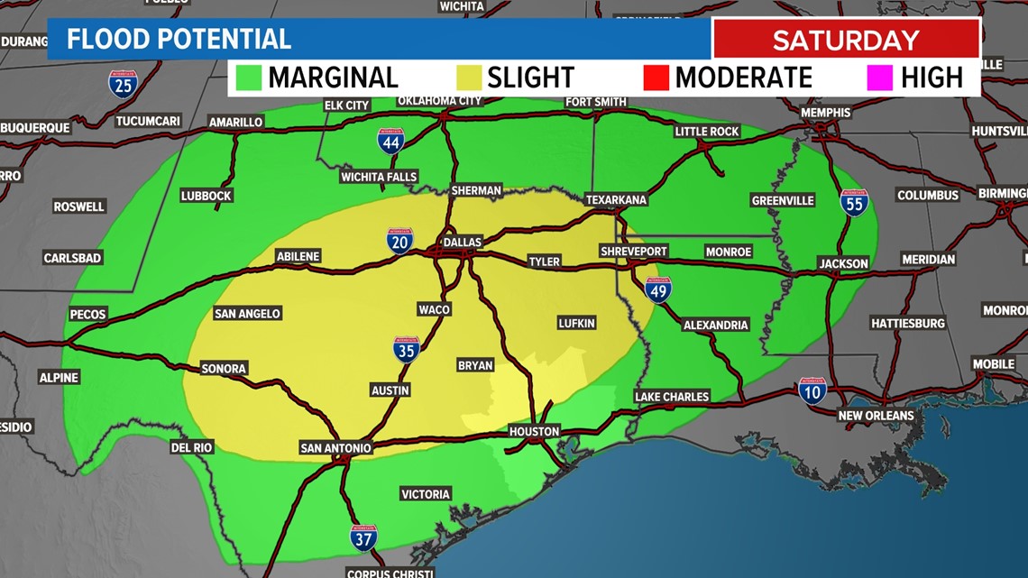
Widespread rain arrives tomorrow. Right now it looks like most areas pick up less than an inch of rain with a few spots seeing more. Overall accumulations are light. Best chance for thunderstorms will happen during the day. The front should be out of here by the evening.

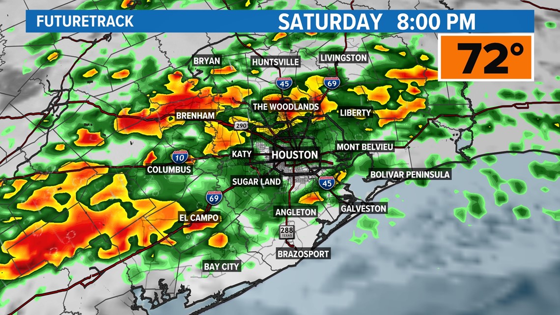
A few inches of accumulation is possible north of Houston and there's where we have a potential to see high water spots and isolated street flooding in poor drainage areas.

The rain looks to clear by noon Sunday but skies remain cloudy through much of the afternoon with the high maxing out in the low 70s. Monday is the picture perfect day with 70s still around and full sunshine back in Houston. Enjoy it was we return to warmth and rain chances after that.

Follow the KHOU Weather Team for live updates on the weather in your area:
- Kim Castro on social media: Facebook | X | Instagram
- Pat Cavlin on social media: Facebook | X | Instagram
- Chita Craft on social media: Facebook | X | Instagram
- David Paul on social media: Facebook | X | Instagram
- Chris Ramirez on social media: Facebook | X | Instagram
- KHOU 11 on social media: Facebook | X | Instagram | YouTube