
HARRIS COUNTY, Texas — Heavy rain across the Houston area caused widespread flooding. It started Wednesday night and went through Thursday afternoon, leading to river and street flooding and both mandatory and voluntary evacuations.
Meteorologist Chita Craft totaled up rainfall amounts for different parts of town. While the rain moved out of the Houston area, the flooding threat remains because what fell north of Houston heads downstream into already swollen and flooded rivers and streams.
RELATED: County Judge Lina Hidalgo signs disaster declaration for Harris County following torrential rainfall
How much rain fell in the Houston area?
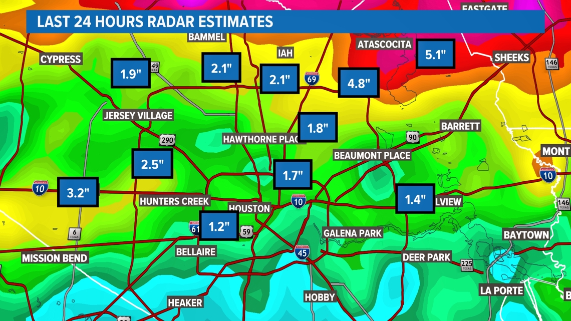
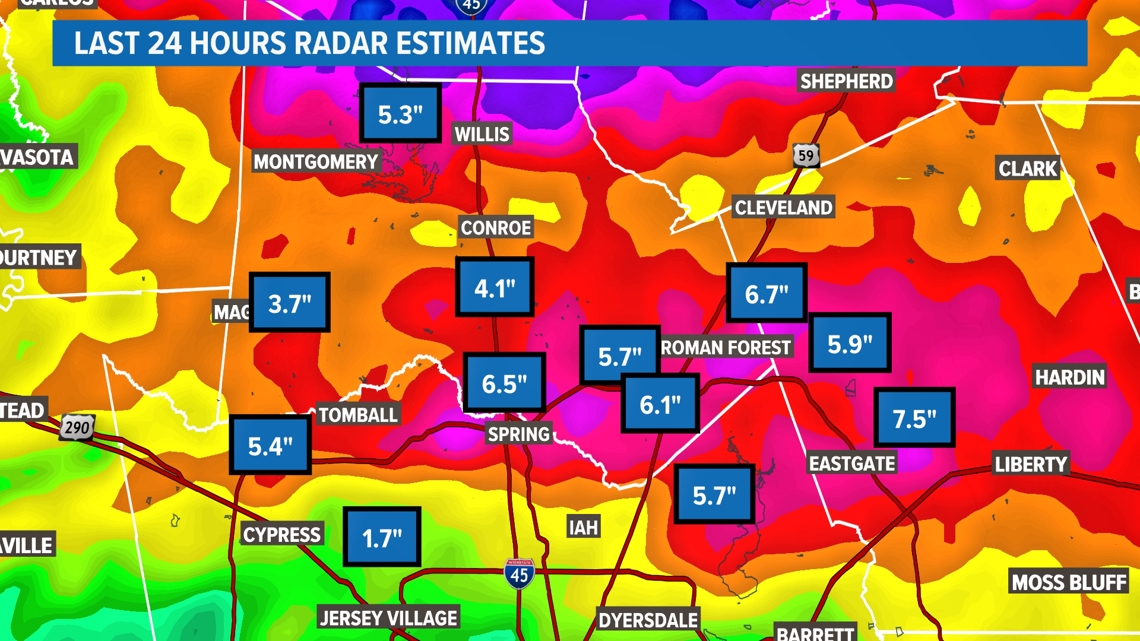
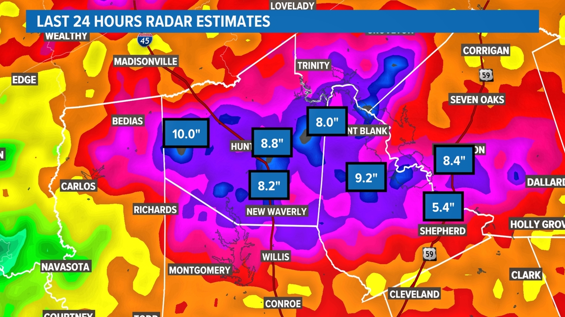
Over the last 24 hours, we've had 1 to 3 inches of rain in Harris County, 4 to 6 inches in northern Harris and Montgomery County with Walker, San Jacinto and Polk counties with the highest totals between 8 and 11 inches of rain within the last 24 hours.
Not only did we see heavy rain the past 24 hours, but it fell on top of the already saturated ground from heavy rain that we saw on Sunday and Monday.
That's why the ongoing flood threat along the San Jacinto River may continue through early next week.
Harris County rainfall totals

Montgomery County rainfall totals

Walker County rainfall totals

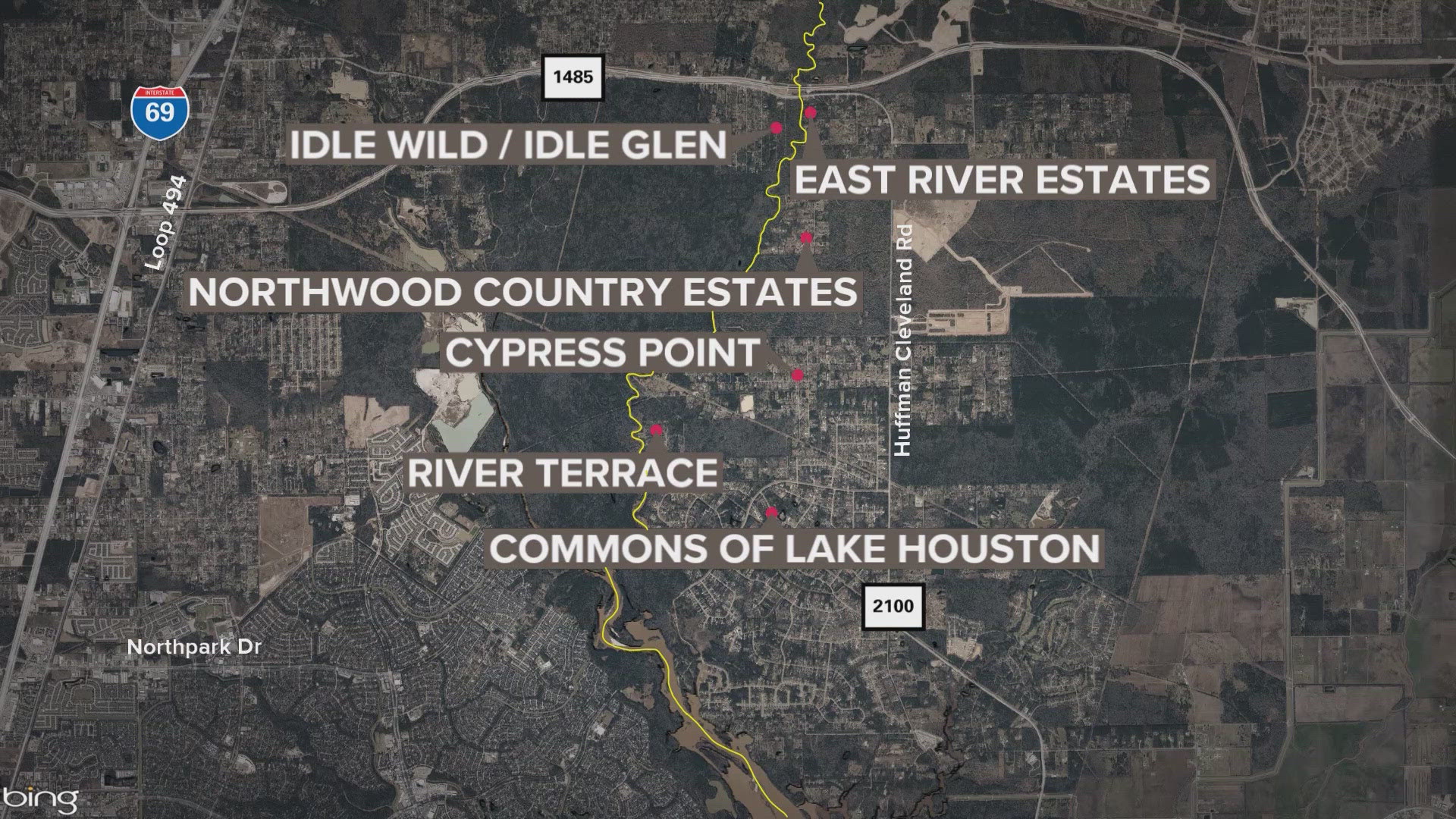
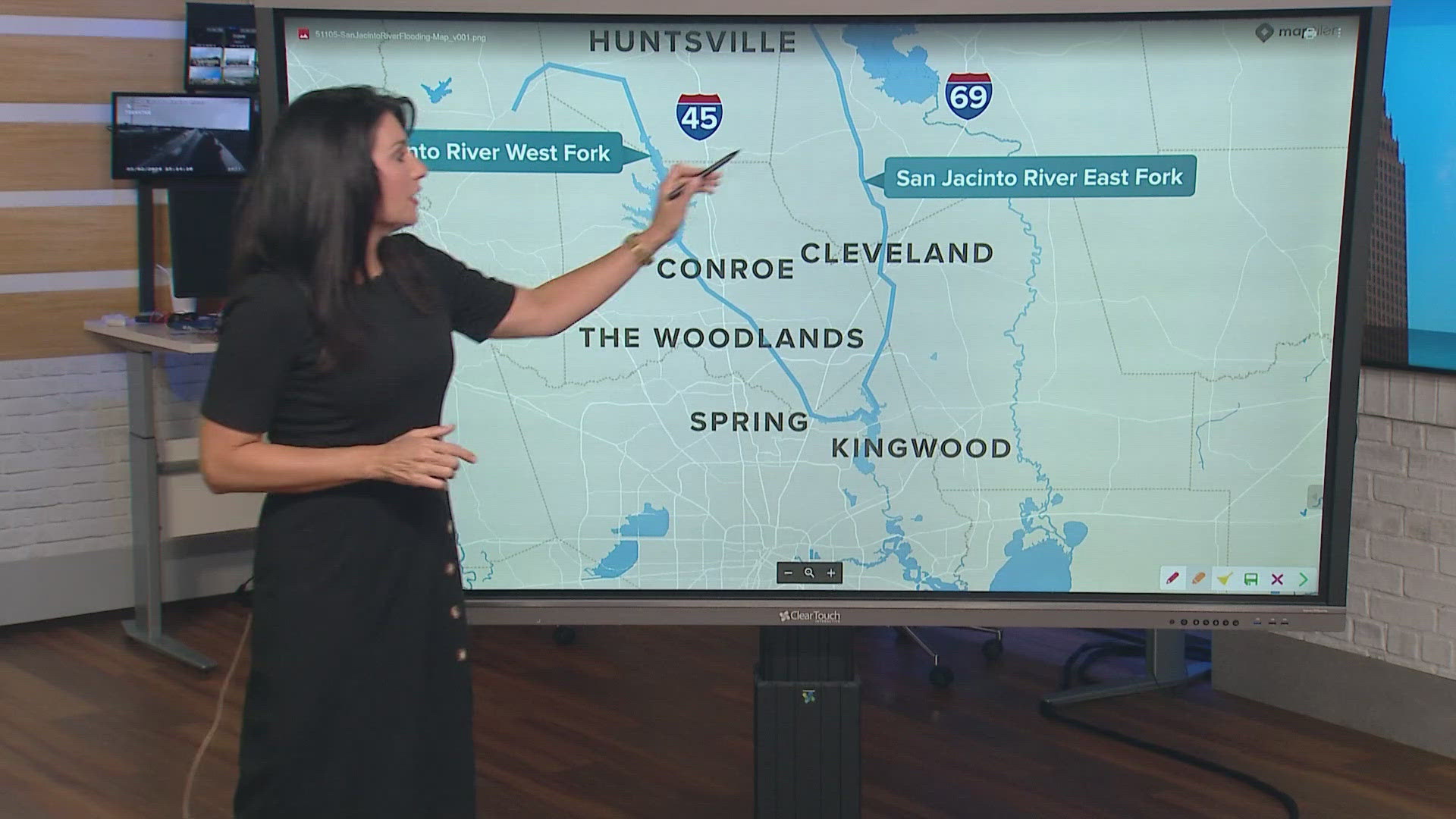
So where does the water go?
KHOU 11's Chery Mercedes took a look at how water north of Houston flows downstream through the east and west forks of the San Jacinto River.
How you can track stream and river levels
Among other things, the Harris County Flood Warning System provides a look at flood gauges across the county, and on Thursday afternoon, it showed that some parts saw close to 8 inches of rain in the past 24 hours.
The default map shows 24-hour rainfall totals, but you can toggle the time frame to look at the past two days or just the past 15 minutes.
If you click “channel status,” you can see what kind of impact rainfall had on bayous. They’re usually all marked green for “no flooding," but can switch to “flooding possible” or “flooding likely."
You can also click on an individual gauge to get more information. For example, on the morning of Aug. 27, the gauge at Taylor Lake and Port Road indicated it received 1.60 inches of rain in the previous 24 hours. One tab breaks down that rainfall by the hour, while another tab allows you to monitor stream elevation.
The warning system also lets you sign up for alerts in your area. First, you’ll need to register. You can use your Facebook, Google or Twitter accounts -- or just sign up with your email and password.
Then you can find the gauges near home or work and sign up for alerts. Those can come via text, email or both. The flood warning system is an easy-to-use tool for any flooding event, including hurricanes. Sign up for ReadyHarris alerts by texting "GULF2021" to 888777.
You can see levels on the Harris County Flood Control District.