HOUSTON — EDITOR'S NOTE: This page will no longer be updated. We're posting the latest Houston weather forecast here.
_______________________
Hot and humid across southeast Texas again today, par for the course here in the middle of August. A symptom of the persistent heat is a stagnant air mass with growing concentrations of ozone via ongoing air pollution. The result is reduce air quality - unhealthy for sensitive groups today.


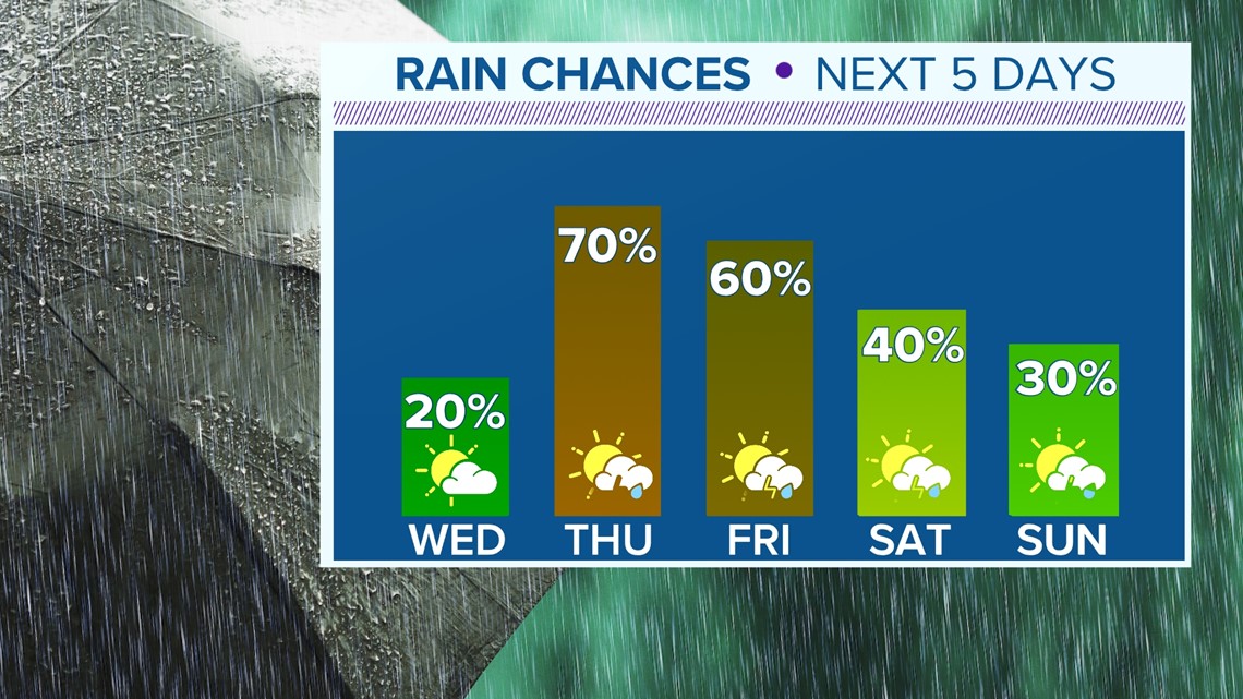
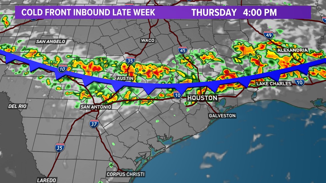
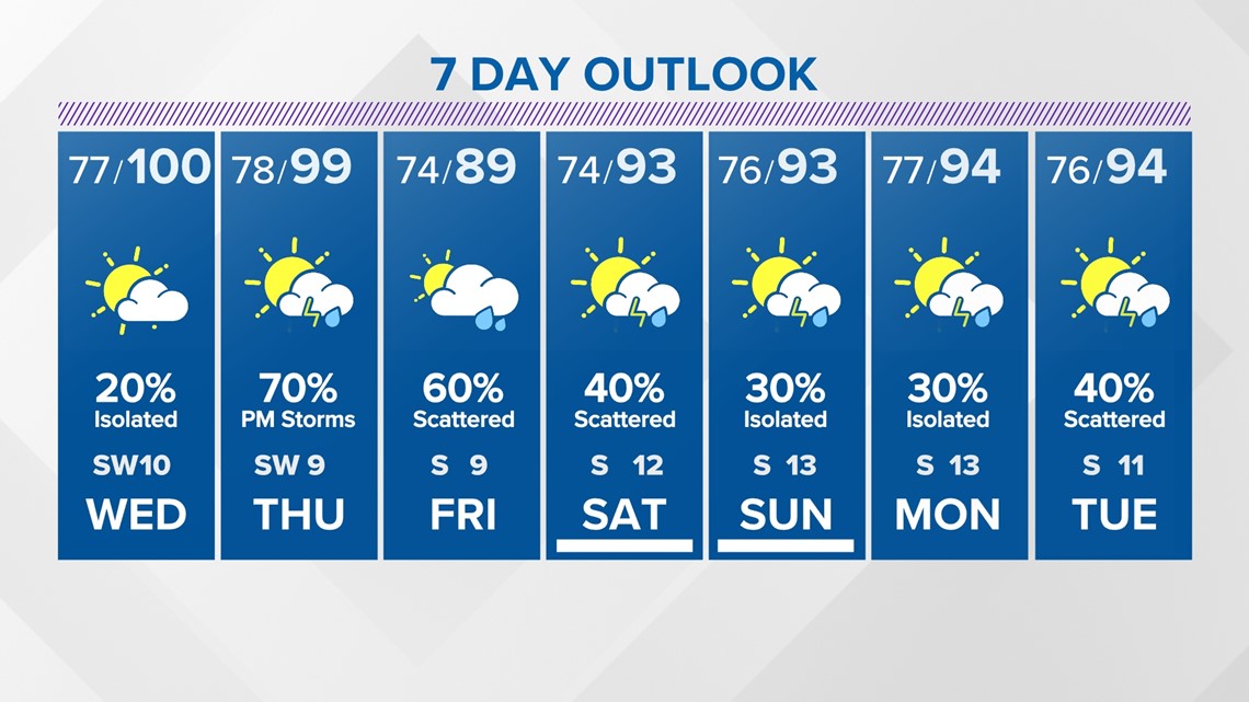
We're in for a few more days of above normal heat as highs climb to near 100° into Thursday afternoon. After that, the pattern changes.
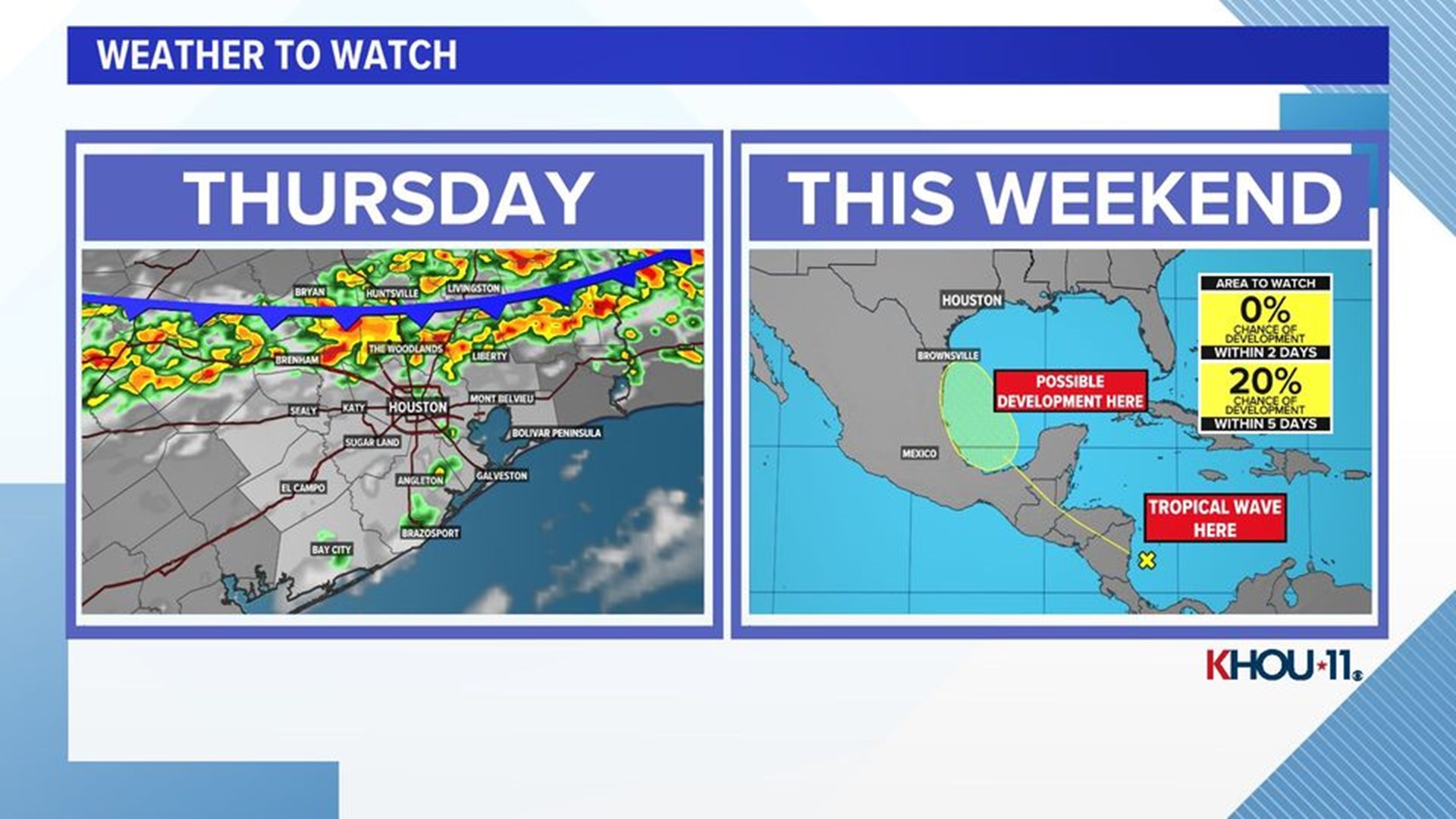
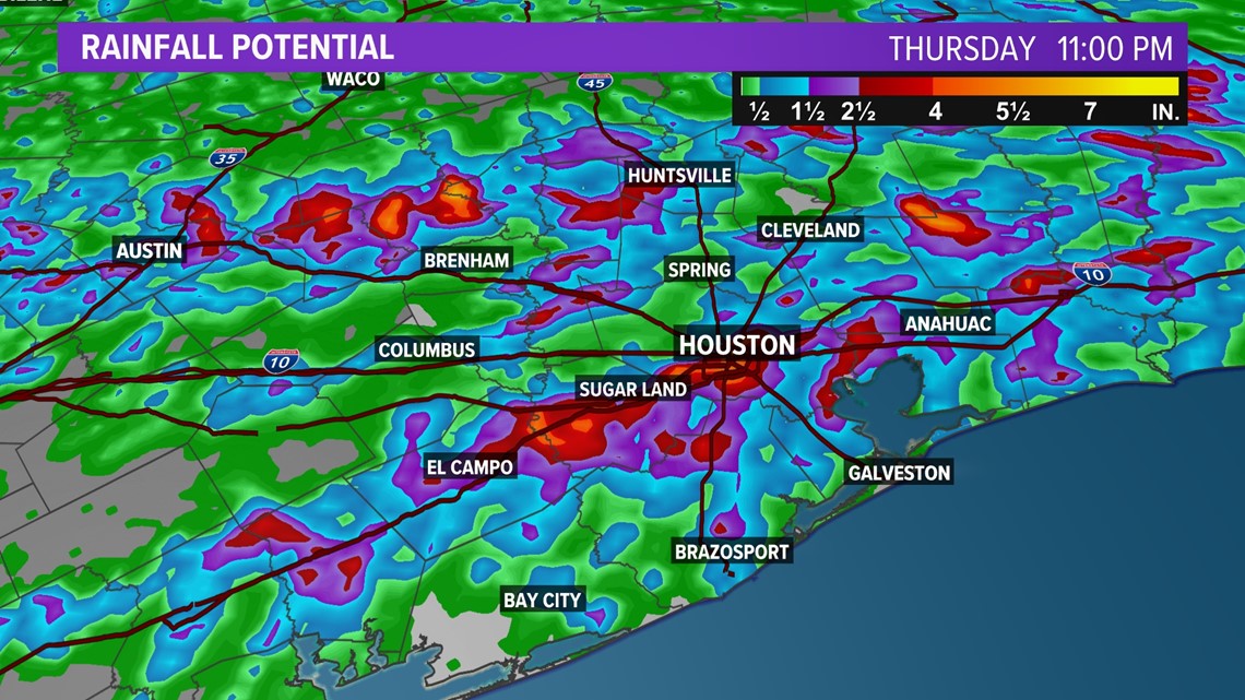
A cold front is forecast to arrive from the north. It's interaction with the hot and humid air mass in place will produce widespread storms and downpours potentially with gusty winds. Rainfall may be impressive in some locations topping a few inches as the front rolls through and then stalls to our south.
Since the front will remain in our general vicinity for a couple of days the risk for rain will accompany it. Shower chances persist into the upcoming weekend.


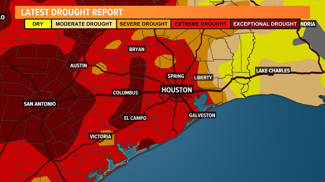
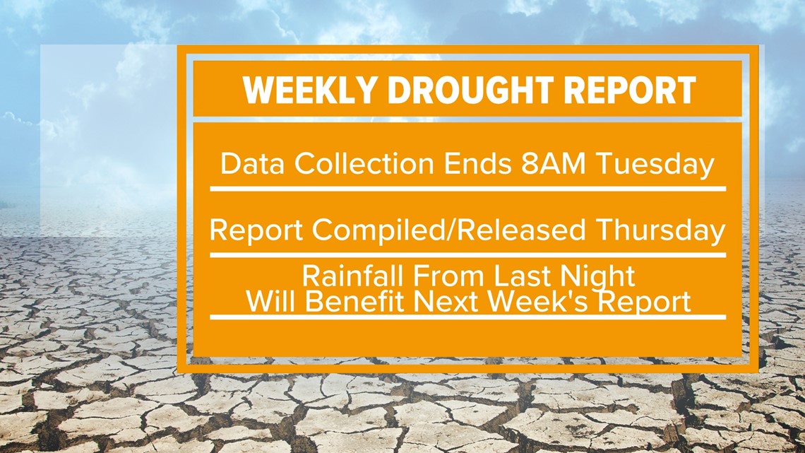
Houston drought monitor


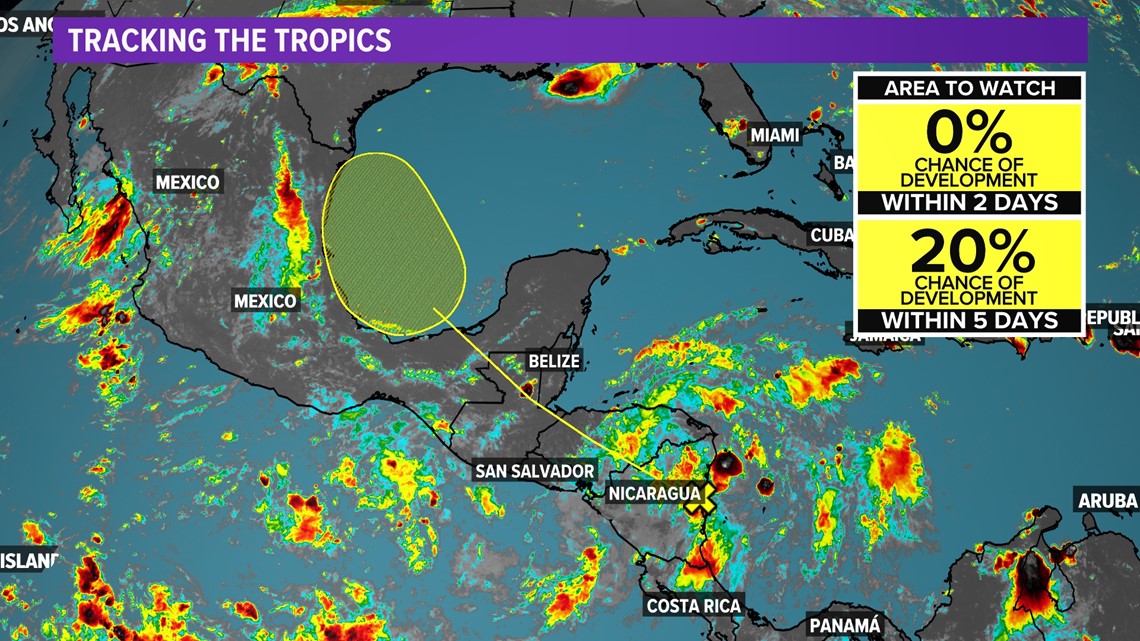
TROPICS
A tropical wave in the southern Caribbean will track northwest over land in the coming days, this interaction will delays any organization until it emerges over the southern Gulf of Mexico later this week. At that point in time development odds are still low, 20% but it may bring more rain to south Texas.

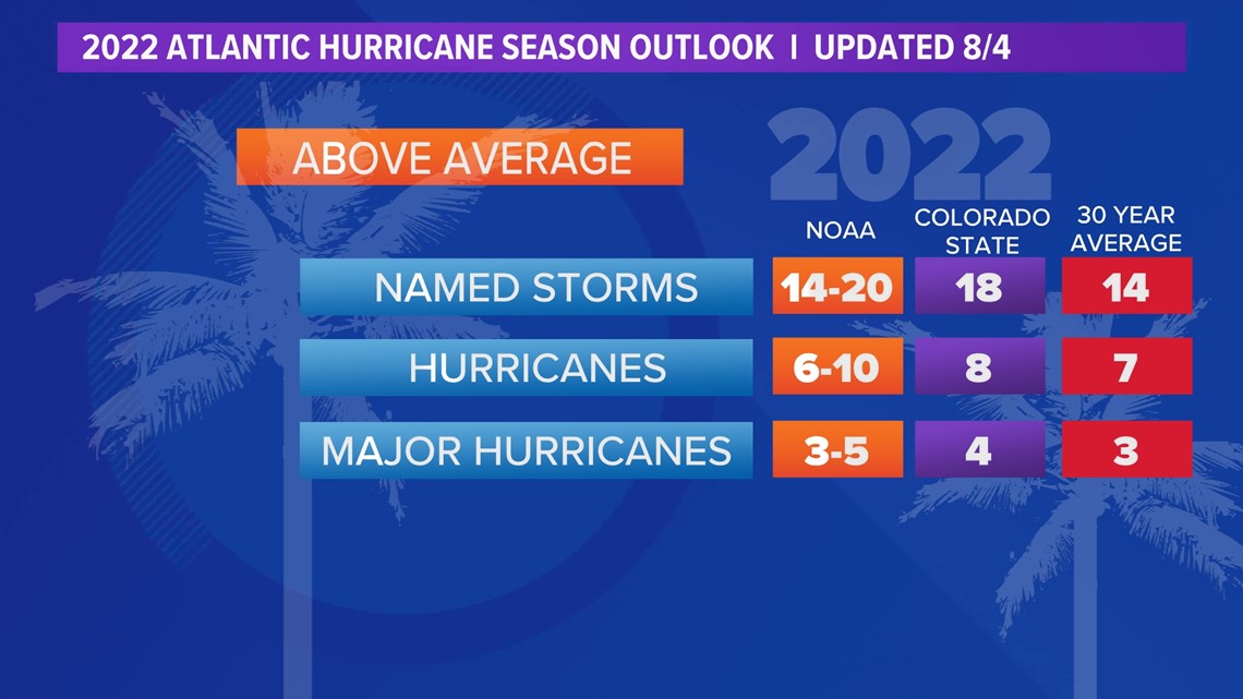
We have an updated projection on hurricane season as we head into the peak of it. With La Niña conditions expected to continue giving way to above-normal sea surface temperatures, the outlook still favors an above-normal season.
The latest predictions have been slightly scaled back from the previous projection.
NOAA has identified a few pockets of cooler sea surface temps, which is why it adjusted its projection of 14-21 named storms to 14-20 named storms. Colorado State has also scaled back ever so slightly going from 19 named storms to 18.