HOUSTON — A powerful storm system from the Pacific will reach Texas by Monday, bringing rain, wind, and the chance for some strong to severe storms.

**If you're going to the game on Monday, you're encouraged to text CFPHouston to 888777 for alerts. You can also download the KHOU 11 app and we'll send alerts for severe weather**
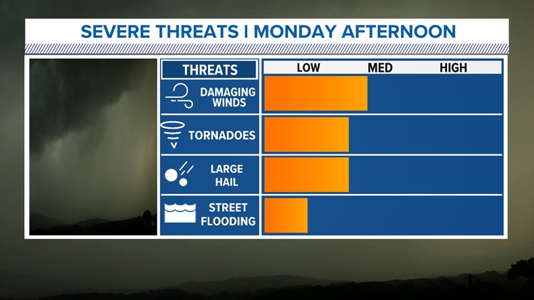
On Monday morning, the Storm Prediction Center (SPC) INCREASED the risk for severe weather in Southeast Texas. Part of the Houston area is now in a 3/5 for severe storms during the afternoon and evening. The orange area is enhanced conditions. That means numerous severe storms are possible, a few of which could be intense.

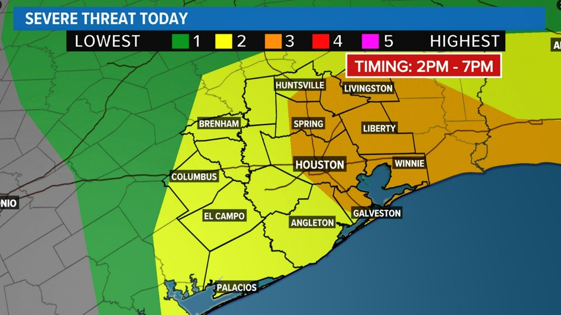
The main threat with any storms that could become severe is straight-line winds that could gust over 60 mph. A few fast-moving tornadoes are not out of the question along with some small-to-medium sized hail. Flooding is unlikely because of how fast these storms will be blowing through the area.


Monday storm timeline:
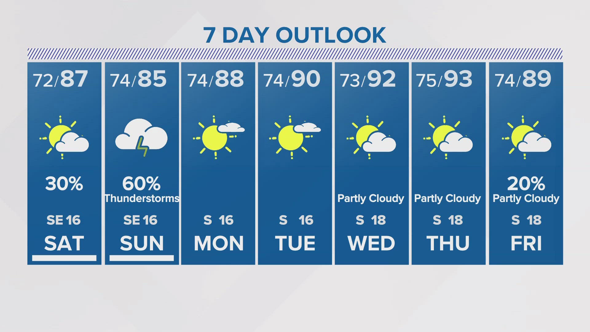
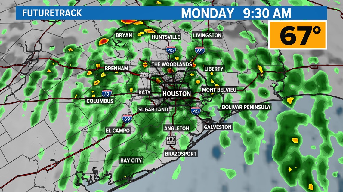
Monday morning -- there will be widespread downpours with a few thunderstorms possible. However, at this point, the atmosphere likely will not be set up for severe storms yet, but rain could make for a rough morning commute.

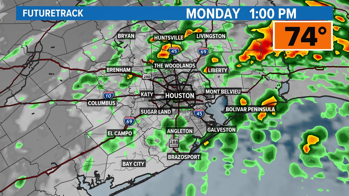
Monday afternoon -- The potential for strong to severe storms is possible as warm air overspreads much of Southeast Texas. This warm air will provide fuel for severe storms to develop, although the risk is fairly low.

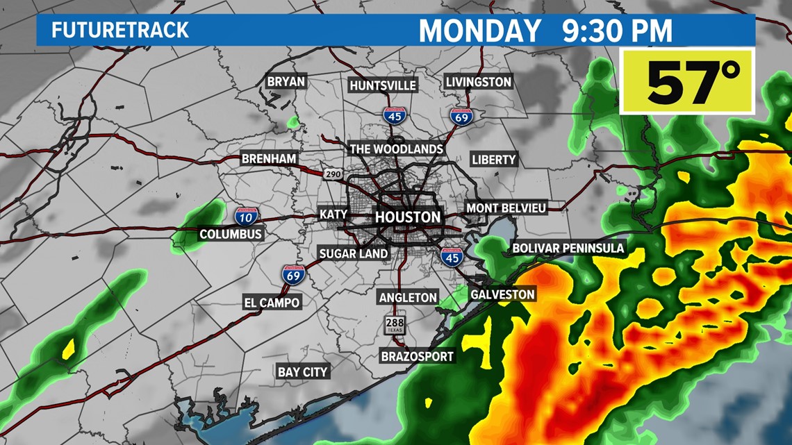
Monday evening -- The cold front will start to approach and a squall line will develop to our northwest. This line will pose the greatest risk for wind damage if it holds together. A few quick spin-up tornadoes cannot be ruled out along this line either.

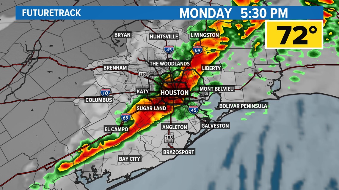
By 10pm, the severe weather threat for the Houston area will diminish with showers and storms moving out of southeast Texas toward Louisiana. Temperatures will quickly drop Monday night into the 40s with gusty winds. Windy conditions are expected to last into much of Tuesday as well with gusts at 25-30 mph.