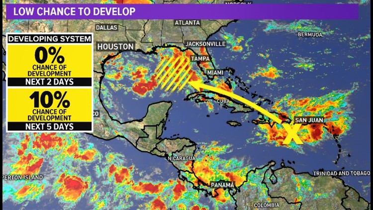
The yellow 'X' represents a tropical wave that may enter the eastern Gulf of Mexico next week. Once there (in the yellow hatched area) environmental conditions may become favorable for further development. The Hurricane Center gives it a 10% chance for now. The weather team is tracking it closely as well.


Sea surface temps in the Gulf are near 90 degrees in spots. That's very warm, but does not mean a storm will form. Just one of the factors we are monitoring.


The Atlantic (above) is waking up off the coast of Africa. A system there is expected to develop into our next named storm 'Florence' as early as Friday.


Fortunately, this one is likely to follow a path that takes it over the open ocean. No threat to the United States at this time.


So, enjoy the Labor Day weekend with friends and family. Nothing to worry about except a chance for scattered thunderstorms. But please 'monitor' the tropics with us at least once a day so no one gets caught off guard.