
HOUSTON — The official start of summer isn't until Friday, but Mother Nature doesn't want to wait to bring in the summertime heat.
The next heat wave is beginning to move in with a ridge of high pressure that will set up shop across the south. Whenever this occurs, this suppresses rain chances and brings above average temperatures.
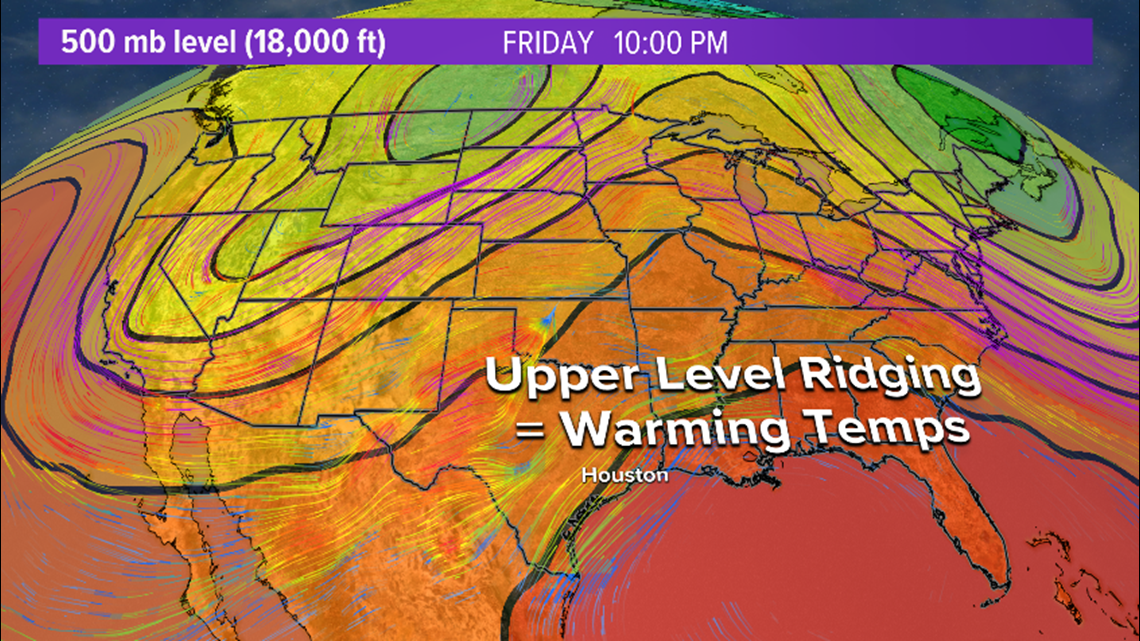
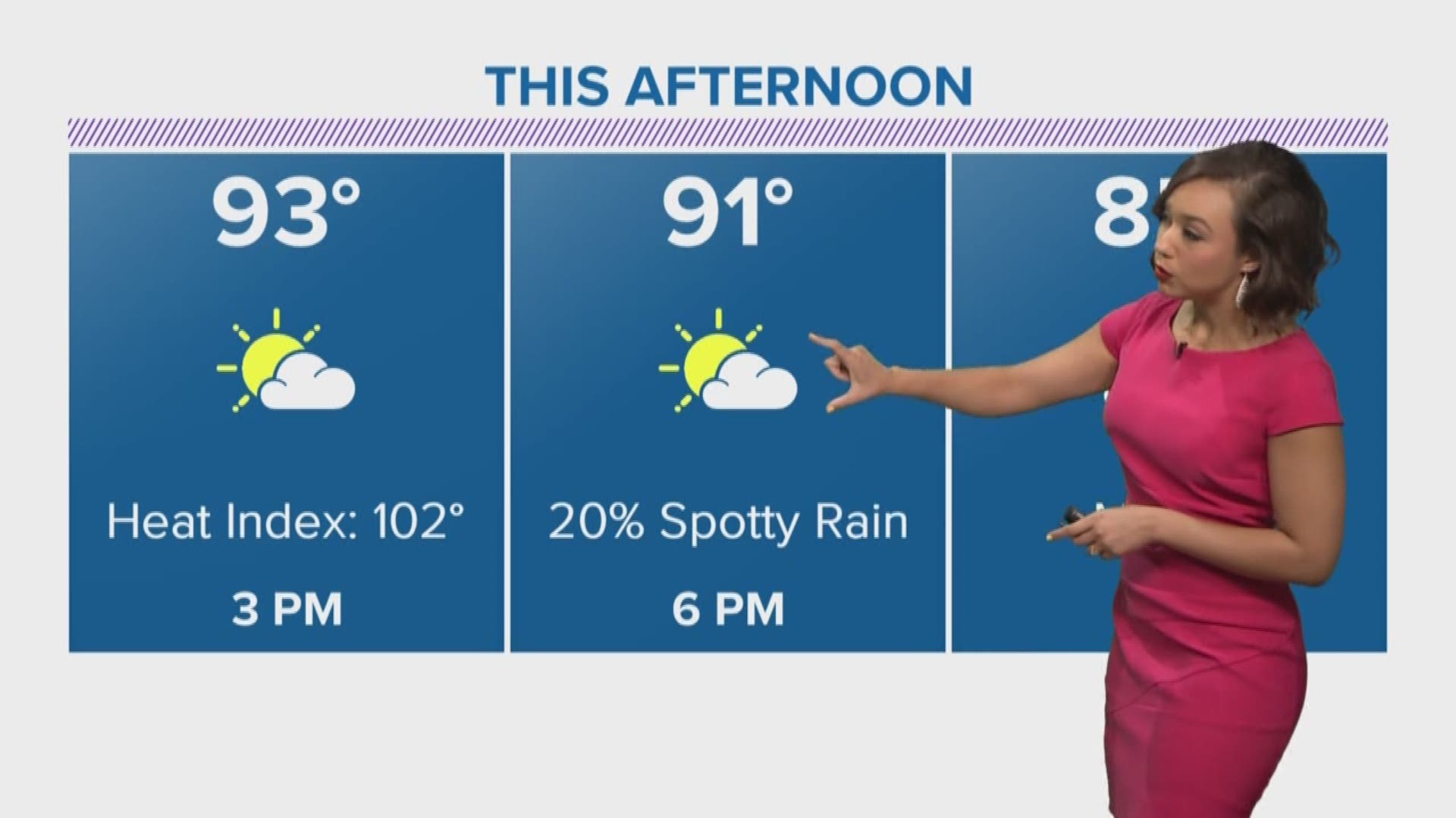
Average temperatures for this time of the year in the Houston area are low-90s. Mid- to upper-90s arrive Wednesday and hang with us through the end of the work week.
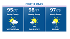
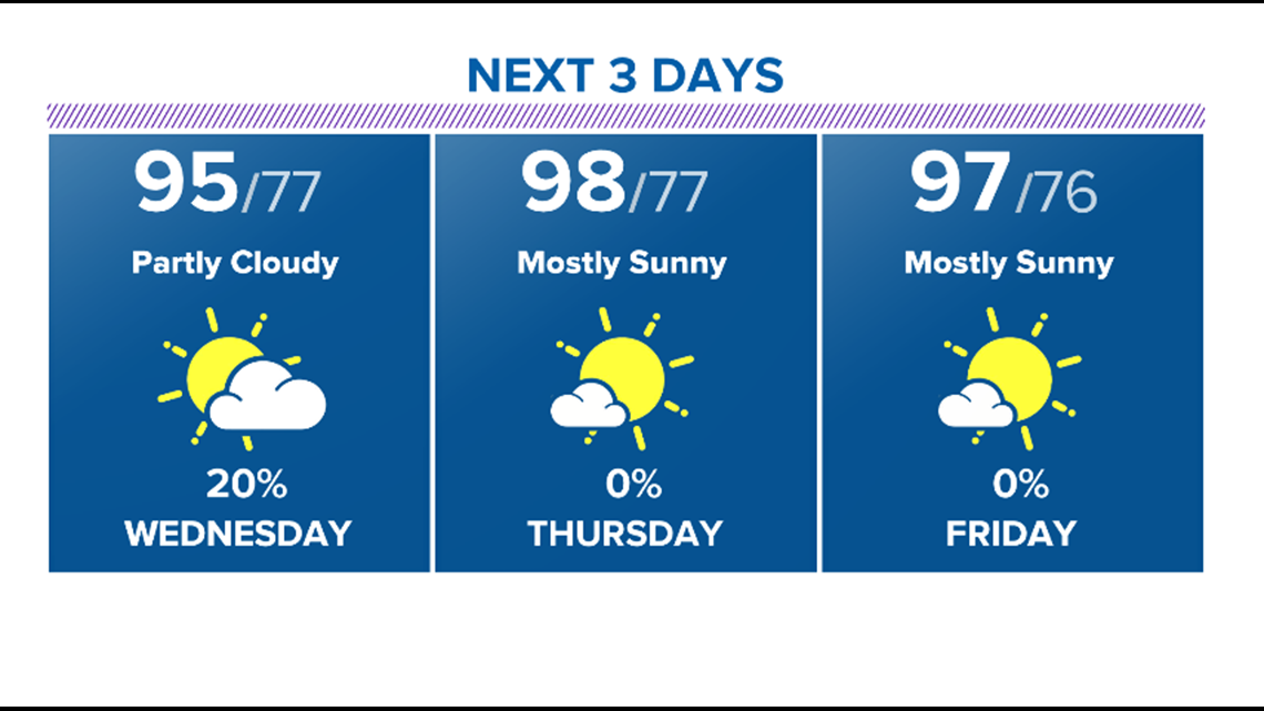
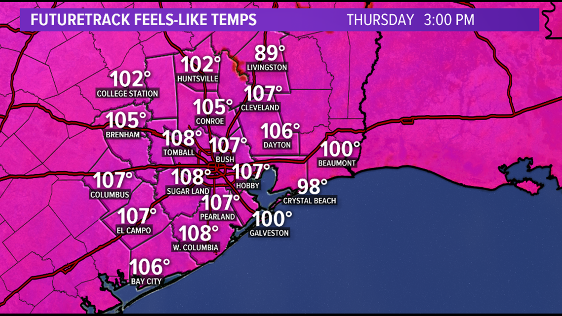
Factor in the humidity, feels-like temperatures will be in the triple digits by Wednesday, but check out the feels-like temperatures we will see by Thursday. Heat index values will range from 100 to 110 degrees.
As we approach peak heat for the summer months, it's very important to listen to your body. Do all you can to protect yourself and your loved ones from the scorching sun or any heat related illness. Try avoiding being out in the sun for extended periods of time. If you do happen do be outside, bring an adequate supply of water. Plan activities earlier in the morning or later in the evening. When getting dressed, try to wear light, loose-fitting clothes and you can add extra protection from the sun with a wide-brimmed hat to protect the face and use sunscreen.
HOUSTON FORECAST: Triple digit heat index values for the next several days
VIEW CURRENT ALERTS: Tap here for watches & warnings active now
WEATHER RADAR: Track rain & storms across Texas
GET ALERTS ON THE GO: Download the KHOU 11 app and follow us on Facebook and Twitter.