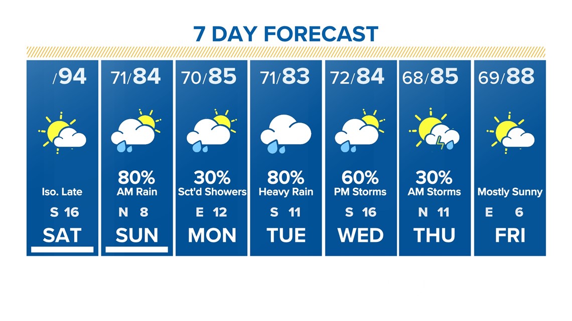
HOUSTON — We begin to see a shift in our overall pattern from hot and dry to seasonable and wet. Emphasis on the wet, we need the rain!
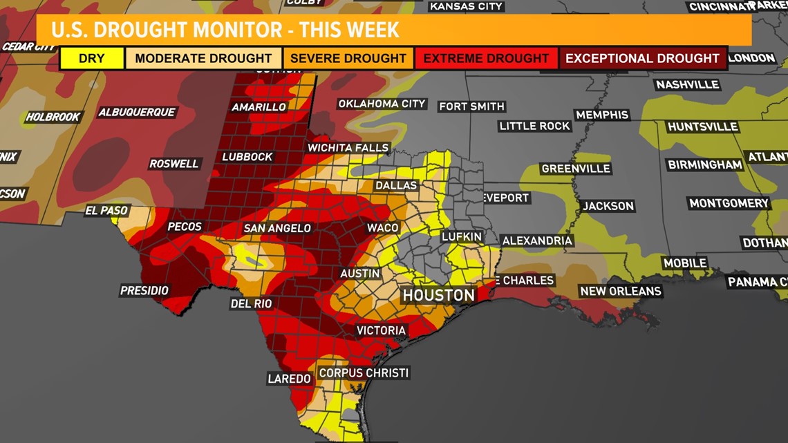
The most recent release of the drought report shows severe and extreme drought conditions expanding over Texas. Rain arriving this weekend will help.
Rain chances taper for Sunday afternoon and remain on the lower end through Monday then once again ramp up Tuesday and Wednesday. They tapper after Thursday morning.


This will be beneficial rain across the state where drought conditions have been worsening week after week.


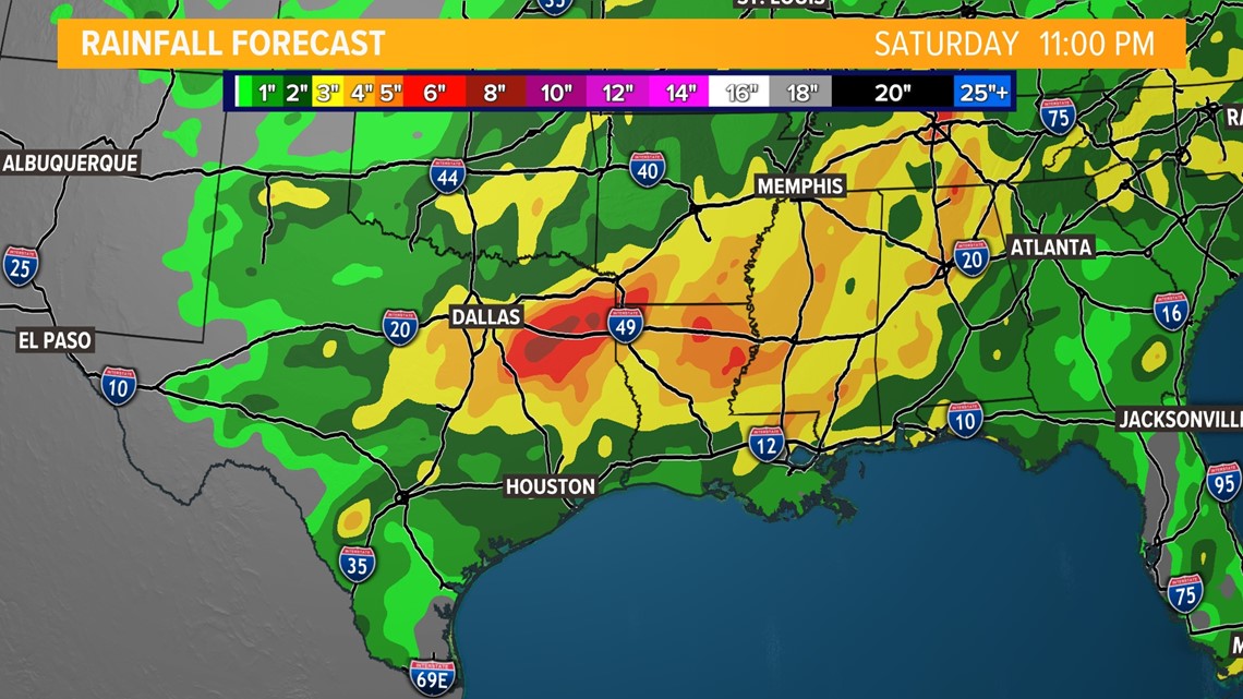
Locally, rainfall totals spread out over those several days may amount to very beneficial totals for many areas, on the order of 2 to 3 inches.

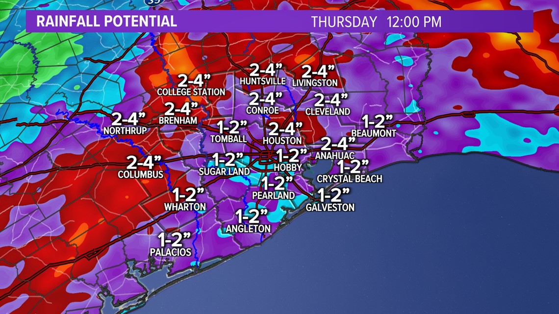
By Thursday our long range models show a general return to drier conditions and warming temperatures.
STAY WEATHER SMART: Get our mobile app alerts
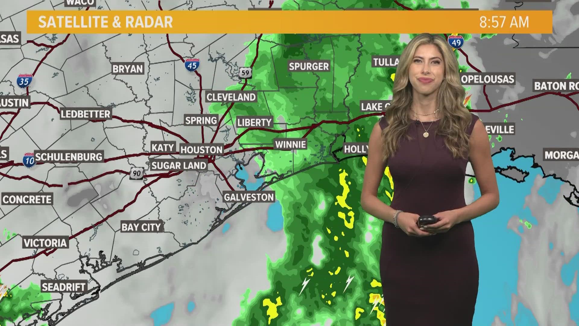
LIVE INTERACTIVE RADARS: Track storms and rain
________________________________________________________________
Here is how the KHOU 11 Weather Team gets the latest information.
KHOU 11 APP: Get our mobile weather alerts
KHOU 11 RADAR: Track Houston storms and rain here