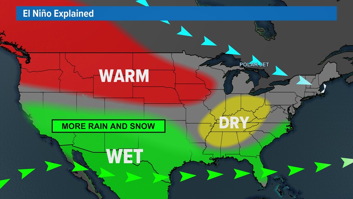
HOUSTON — Although we've warmed up the first week of November, more wet weather is on the horizon and an El Niño year is to be expected.
Along with the El Niño favoring a wet outlook for the southern half of the U.S., it also favors colder weather.
So, what does cold precipitating form? Snow -- That is if it's cold enough.
The South is notorious for its hot and humid summers and more temperate winters, which is why winter precipitation isn't common. It does, however, make spots that are a bit colder, like the mountainous west more susceptible to the snow.
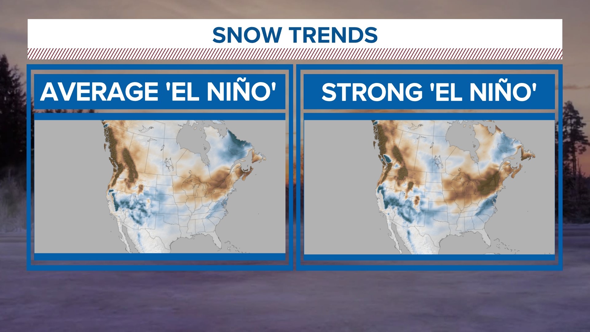
The Sierra Nevada Mountains and the Rockies get that snow bullseye because of the cooler, higher elevation air coupled with the wet weather source from the southern Subtropical Jetstream.


This year NOAA is not only calling for an El Niño but also calling for a stronger El Niño. Based on 30 years of historical data (1990-2020), this signals that snow trends could become more pronounced.
You'll notice the patch of blue stretched out horizontally a bit further, touching Oklahoma and North Texas.


It's important to note that this is not a forecast, but rather a prognosis of what could happen based on what's happened in the past--on average, but not every year is the same.
So will the snow trend happen this year? What could this mean for Houston? It's too early to tell.
What we do know is you should keep us in your back pocket this winter season. The KHOU Weather Team will be keeping close tabs on the evolving forecast for you.

