HOUSTON — Wintry weather could be in the making if latest computer models have their way. While nothing is a guarantee when it comes to weather--especially winter weather in Texas--it certainly bears watching, even here locally.
It's a difficult forecast because the air coming in is modified arctic air that is barely cold enough to support frozen precipitation. This isn't a blistering cold airmass like we saw last January when the temperatures in Houston could barely crack 25 degrees in the middle of the afternoon. No, this is a much different set up and one that is notoriously difficult.
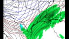
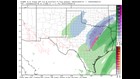
We've been watching the models for a few days now and while the GFS (American), ECMWF (Euro) and CMC (Canadian) all show wintry weather, it's of different intensity and location.
Let's break it down only using the very latest computer models as of this entry:
The GFS model:
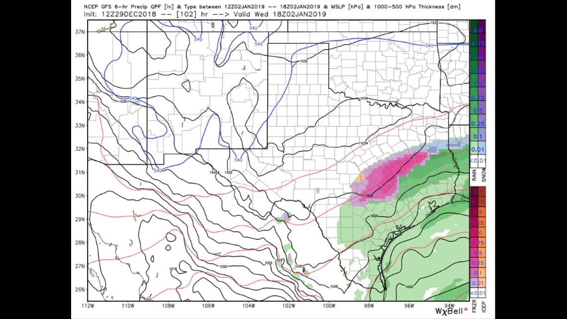
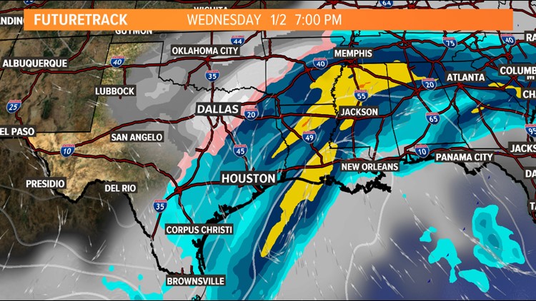
This model has been fairly consistent with the idea of a warmer atmospheric profile (supporting rain instead of something frozen) for Houston while it continues to advertise an icy mess from an Austin, Madisonville, Nacogdoches line northward to about Coriscana but staying south of the Dallas/Fort Worth metro area. This scenario would be impactful but nothing overly severe. Overpasses on Wednesday morning could become temporarily dicey in this scenario for areas well, well north of Houston.
The Canadian (CMC) model:
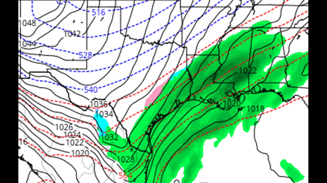
Like the GFS model, the Canadian keeps the storm system very progressive and much weaker than its counterparts (GFS and Euro). This solution also aligns with the GFS in showing a cold rain for Houston and a light icy/rainy mix across central Texas from Austin to Waco and points east. This solution would be the least impactful of all the other guidance.
The Euro Model:
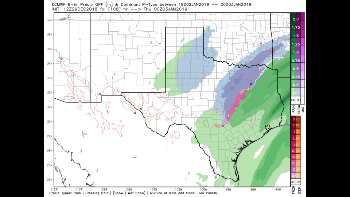
This model is a full blown Texas winter storm. It brings a strong area of low pressure across the state with wide ranging impacts from San Antonio to Austin to Waco to Dallas and points further north and east. While this model is the coldest and the most robust with any precipitation and the severity of the cold, it too keeps the precipitation in Houston all liquid -- although areas from Brenham to Conroe to Livingston and points north would be on the cusp of a switch over to wintry weather. This scenario is the outlier currently and will have to be watched closely. This model would give the best chance of wintry weather in some of our northern outlying suburbs. NOT guaranteed.
Let's see what the National Weather Service offices had to say about this.
NWS, Austin/San Antonio:
"With models trending both wetter and colder for this system, confidence is increasing that the northern portions of our county warning area may see freezing rain Tuesday night into Wednesday morning. It still may be too soon to determine the impacts for this event, but due to the sensitivity of all the variables involved with this forecast, it is important to stay up to date on weather updates, espeically if traveling in the Hill Country."
NWS, Fort Worth/Dallas
"The forecast gets a bit more complicated as we approach sunrise Wednesday with regards to the upper pattern. The ECMWF (euro) solution continues to amplify a deep closed low over southern New Mexico, the GFS is much weaker and keeps the upper low farther west, and the Canadian solution keeps the upper trough open and progressive. The reason this is so problematic is that the position of the upper low is critical to the amount and location of moisture return as we head into Wednesday morning and since surface temperatures will be near or below freezing, any precipitation could be of the freezing variety. For now, have opted to stay closer to the GFS/Canadian solution and only mention light rain/light freezing rain mix, especially south of a Canton, Waco, Lampasas line. Since surface temperatures should remain above 30 degrees during the morning hours where the precipitation occurs, very little if any impacts are expected."
NWS, Houston
"...Temperatures will take even more of a tumble Wednesday night inot Thursday with low temperatures falling into the low 30s to 40s, with locations along and north of a line from Colorado to Montgomery to Polk County could reach slightly below freezing temperatures. Model guidance in the extended though has varied, with the most recent runs trending on the colder side, so will have to follow these trends closely."
The Bottom Line:
That's a whole lotta type to explain a weather pattern that can be summed up in a single word: uncertain.
It looks very likely that our area will see widespread precipitation on Wednesday. The question is just how cold those temperatures get and if any hydrostatic cooling can help us reach that magical benchmark to see some wintry weather in Texas. That's a question that we won't be able to answer for a few more days.
There is no guarantee that any one area of Texas will see wintry weather. Model guidance is all over the board but it's definitely something we should watch. While Houston remains too warm for wintry weather, per model guidance, there remains much uncertainty in the forecast--even here locally. I've lived here too long and seen too many "surprises" unfold before our eyes as these events get underway.
Don't hold on to false hope but don't turn a blind eye to it either. Let's just keep watching, winter weather lovers.