
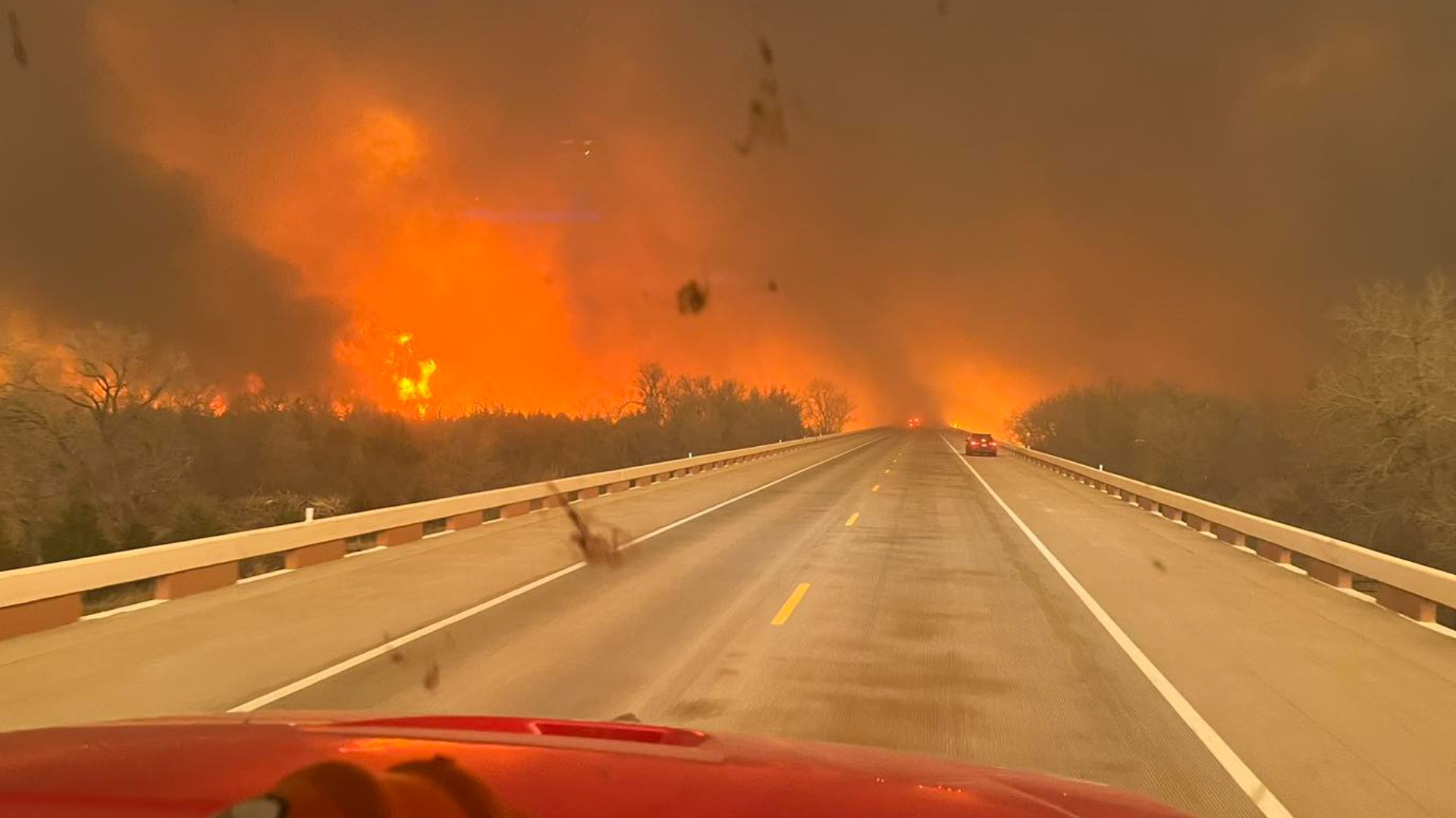
TEXAS, USA — The explosive growth of the second-largest wildfire in Texas history slowed as winds and temperatures dipped but the massive blaze was still untamed and threatening more death and destruction.
Firefighters in the Texas Panhandle have made little progress corralling it – containment was at just 3% -- but Thursday’s forecast of temperatures in the 40s and a chance of rain offered a window to make progress before temperatures and winds increase this weekend.
Authorities have not said what ignited the fires, but strong winds, dry grass, and unseasonably warm temperatures fed the blazes.
An 83-year-old grandmother is the only confirmed death so far but with flames still menacing a wide area authorities have yet to conduct a thorough search for victims or tally the numerous homes and other structures damaged or destroyed.
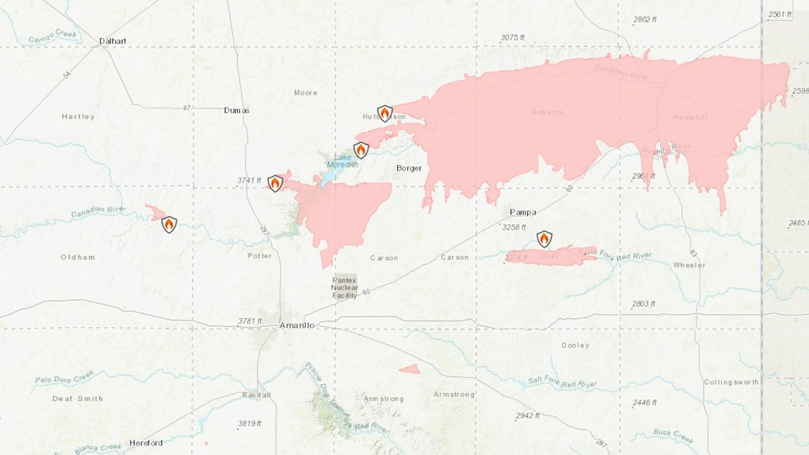
Below are links showing maps to which you can track the progress of the wildfires and the communities they threaten.
Maps of wildfires across Texas
The Smokehouse Fire is the largest of several major fires burning in the rural Panhandle section of the state. It has charred 1,300 square miles and crossed into Oklahoma.
Gov. Greg Abbott issued a disaster declaration for 60 counties.
Maps of wildfires across Texas:

Links from Texas A&M:
Air quality across Texas
As wildfires burn in the Texas Panhandle, officials are monitoring the air quality as smoke moves across the state.
Texas air quality forecast
The Texas Commission on Environmental Quality produces air quality forecasts for the state.
You can check the air quality where you live here or in metro areas below:
Interactive map of air quality
Monitor the air quality using the interactive map below: