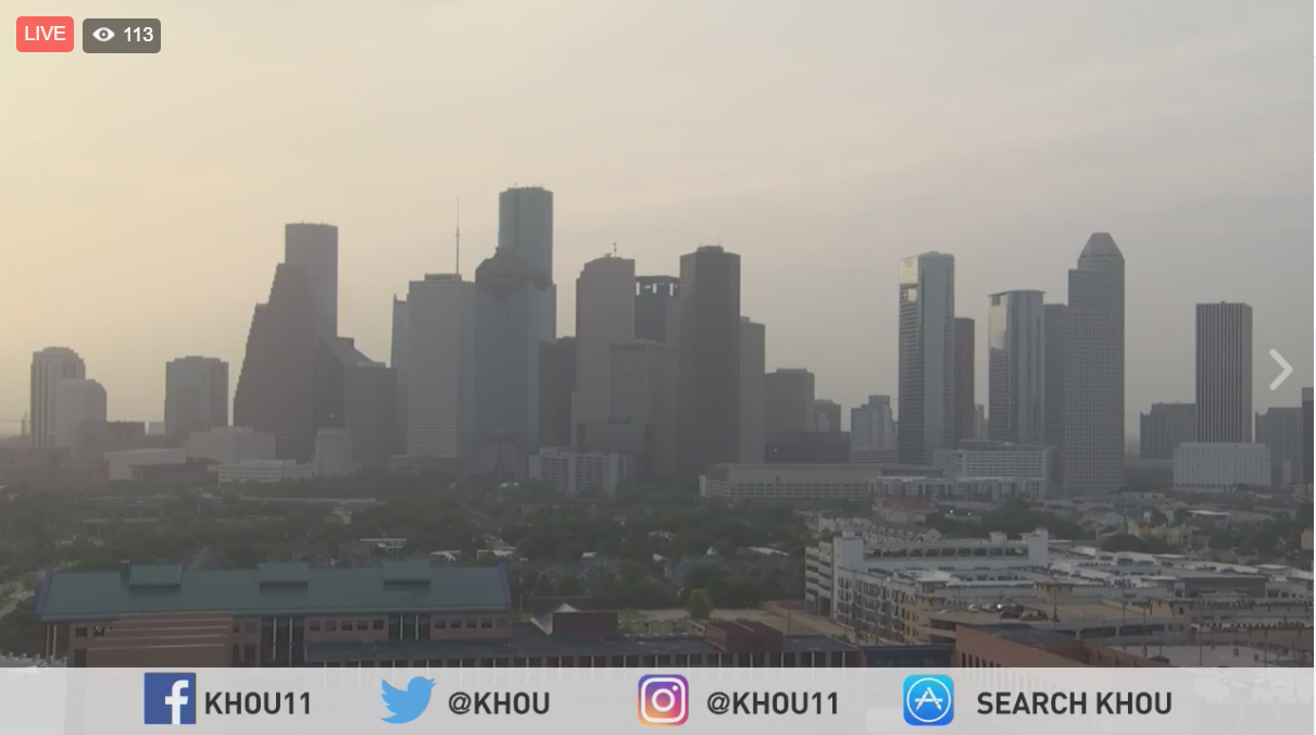
You may notice a milky haze in the skies today. There's a thin layer of dust located between 6,500-6,800 feet up. At sunrise and sunset, it takes on a decided tinge of yellow, not unlike a Moroccan sky. This is in part because, you're seeing particulate matter blown here all the way from dust storms in the Saharan Desert, over 5,000 miles to our east!
The dust will clear by tomorrow so skies will look a lot bluer.
There's some neat things to learn when it comes to this phenomena.
You'll see haze in the skies today. There's a thin layer of Saharan dust, located at about 6,500 feet. The dust will clear tomorrow. #SAL pic.twitter.com/w6aHuIJj9O
— Brooks Garner (@BrooksKHOU) July 24, 2017
This, "Saharan Air Layer" (SAL) can have several, subtle effects on our weather -- and ecosystem.
- The dust obscures the sky, fractionally reducing solar insolation, keeping temperatures a degree lower than they'd otherwise be.
- Inhibits clouds and rainfall development as the dust enhances, "capping" in the atmosphere. As the airborne particles absorb sunshine, they warm. This, "artificially" hot layer -- which can mimic temperatures and humidity levels of the Saharan desert -- slows, or in some cases can actually stop air from rising to create thunderstorms. (This effect usually enhances capping that already exists, because strong vertical forces can usually overwhelm this inhibiting effect.)
- Some people report worsening allergies, in the form of sneezing.
- A portion of the dust will fall to Earth and this is actually an important iron source for coral reefs from the Florida Keys to the offshore waters of Texas.
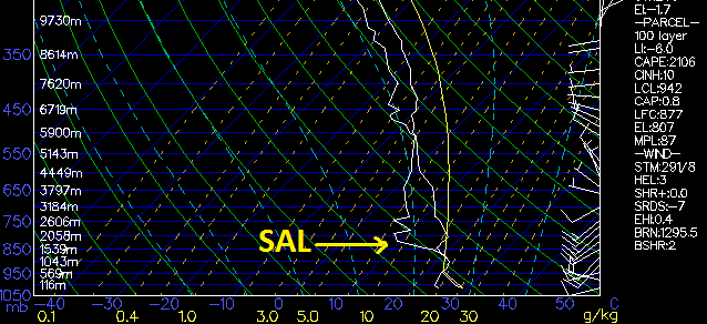
Beyond physically seeing it, you can spot the SAL on a SKEW-T weather chart. It presents itself as a spike of lower dew points and warmer air. This balloon sounding shows this effect most prominent today around 6,700 feet with a depth of about 500 to 1000 feet.
The SAL is also useful in that it can kill hurricanes! The desert-like air can get entangled into the tropical cyclone's circulation, interrupting the heat engine and ultimately slowing it down or dismantling it.
So when you look up and see that haze, you know there's more than meets the eye. It's not just, "Houston pollution", but a force which acts as an important influence on many of our planet's systems.