
HOUSTON — We'll get a break from area-wide rain on Saturday before heavy downpours return Sunday. Storms have already brought flooding to Southeast Texas over the past few days.
Current watches and warnings
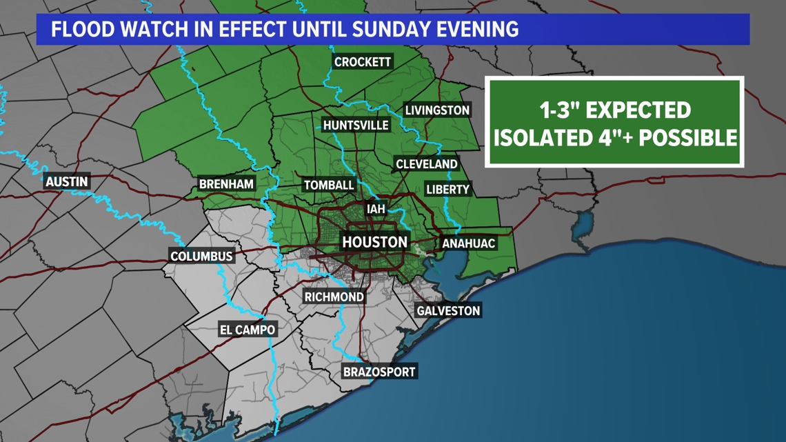
- A Flash Watch is in effect for Brazos, Burleson, Coastal Harris, Grimes, Houston, Inland, Harris, Madison, Montgomery, Northern Liberty, Polk, San Jacinto, Southern Liberty, Trinity, Walker, Waller and Washington until Sunday afternoon.
Flash flood watch now in effect until Sunday evening.

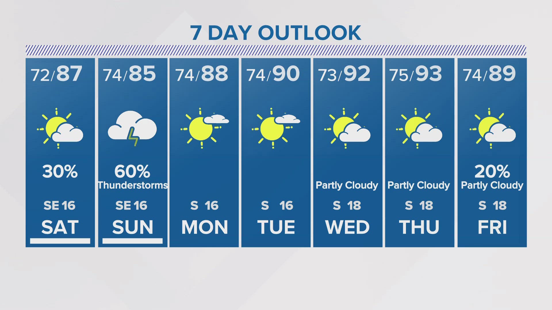
Saturday, May 4
Saturday will be partly sunny, with a high near 83. There will be a southeast wind of 5 to 15 mph, with gusts as high as 20 mph. An isolated shower possible throughout the day. Heavier rain arrives Sunday.
Sunday, May 5
There is a 30 percent chance of showers and thunderstorms, mainly after 1 p.m. Sunday It will be mostly cloudy, with a high near 83.


Sunday night, there is a 20 percent chance of showers and thunderstorms before 1 a.m. It will be mostly cloudy, with a low of around 74.
Follow the KHOU Weather Team for live updates on the weather in your area:
- Kim Castro on social media: Facebook | X | Instagram
- Pat Cavlin on social media: Facebook | X | Instagram
- Chita Craft on social media: Facebook | X | Instagram
- David Paul on social media: Facebook | X | Instagram
- Chris Ramirez on social media: Facebook | X | Instagram
- KHOU 11 on social media: Facebook | X | Instagram | YouTube