
HOUSTON — It's been another day of heavy rain and storms around Southeast Texas, as parts of the Houston area are underwater.
Current watches and warnings
- A Flash Flood Warning is in effect for northeast Grimes, southwest Houston, east Madison, northwest Polk, northwest San Jacinto, south Trinity and central Walker counties until 3 p.m.
- A Flash Flood Warning is in effect for north central Montgomery County, southern Polk County, northern San Jacinto County, and southeastern Walker County until 1 p.m.
- A Flash Flood Warning is in effect for northwest Liberty, central Montgomery and southwest San Jacinto counties until 1:30 p.m.
- A Flood Warning is in effect for the following counties: Harris, Liberty and Montgomery until 5 p.m.
- A Flash Watch is in effect for Brazos, Burleson, Coastal Harris, Grimes, Houston, Inland, Harris, Madison, Montgomery, Northern Liberty, Polk, San Jacinto, Southern Liberty, Trinity, Walker, Waller and Washington until Friday afternoon.
These storms moved in from the west and have produced very heavy rainfall, damaging wind gusts, and even an isolated tornado.
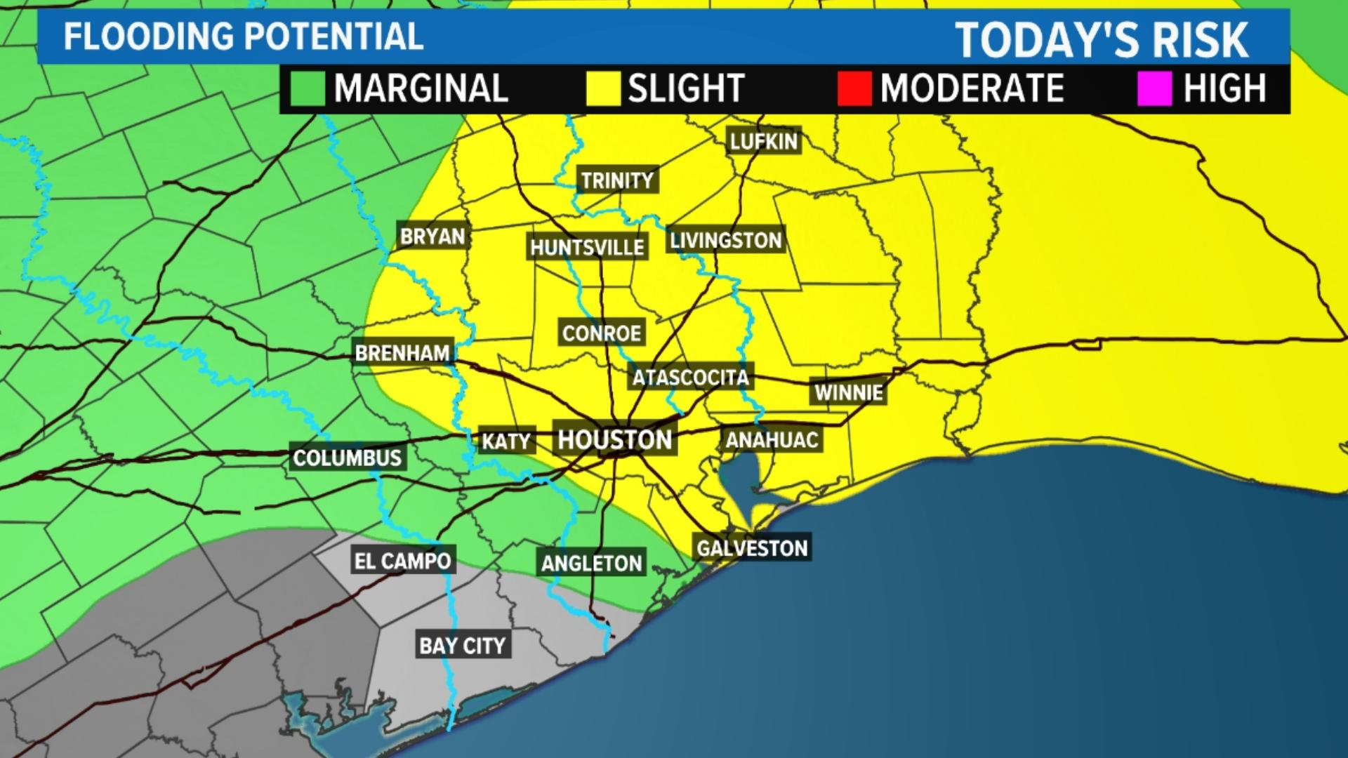
As a result, the Weather Prediction Center from NOAA has placed areas north of the city under a level 3 out of 4 for flash flood potential. This area is very saturated from the heavy rain over the weekend, so any additional rainfall will easily lead to flooding.


Friday, May 3
There is a 50 percent chance of showers and thunderstorms, mainly before 2 p.m. It will be mostly cloudy, with a high near 82. There will be a southeast wind of 10 to 15 mph, with gusts as high as 20 mph.
New rainfall amounts between a quarter and half of an inch are possible.


Friday evening will be mostly cloudy, with a low of around 73. There will be a southeast wind of 5 to 15 mph, with gusts as high as 20 mph.


Saturday, May 4
Saturday will be partly sunny, with a high near 83. There will be a southeast wind of 5 to 15 mph, with gusts as high as 20 mph.


There is a 20 percent chance of showers and thunderstorms after 1 a.m. It will be mostly cloudy, with a low of around 74. There will be southeast wind around 10 mph, with gusts as high as 20 mph.


Sunday, May 5
There is a 30 percent chance of showers and thunderstorms, mainly after 1 p.m. Sunday It will be mostly cloudy, with a high near 83.


Sunday night, there is a 20 percent chance of showers and thunderstorms before 1 a.m. It will be mostly cloudy, with a low of around 74.
Follow the KHOU Weather Team for live updates on the weather in your area:
- Kim Castro on social media: Facebook | X | Instagram
- Pat Cavlin on social media: Facebook | X | Instagram
- Chita Craft on social media: Facebook | X | Instagram
- David Paul on social media: Facebook | X | Instagram
- Chris Ramirez on social media: Facebook | X | Instagram
- KHOU 11 on social media: Facebook | X | Instagram | YouTube