HOUSTON — Tuesday's high temps ran the table from chilly out west for Brenham and College Station, to warm and humid for Galveston and Beaumont.
That will change on Wednesday as the cold front pushes east and opens the door for cold air to move in across the entire area.

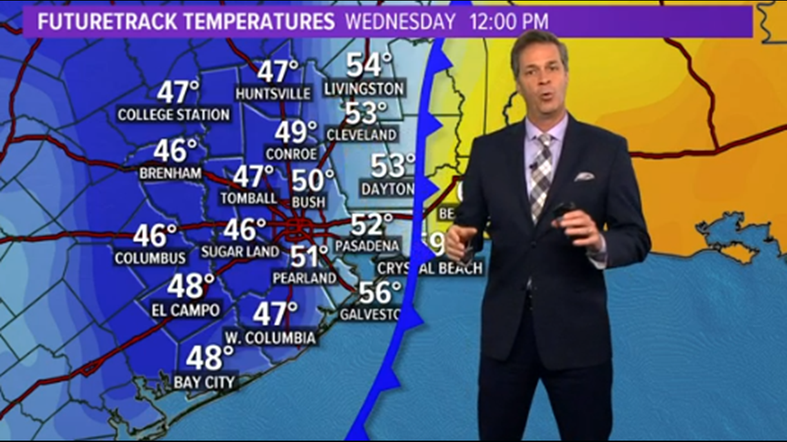
That means places like Brenham, Katy, Sugar Land and downtown could be wearing sweaters with the heat on, while 50 miles to the east, the AC is cranked and we're in shorts and T-shirts.
Now, the front will eventually push all the way off the coast by Wednesday night, bringing in perhaps the first 40s for the area by Thursday morning.
In fact, this front will keep us cleared out all the way through the coming holiday weekend.
It's the same front bringing significant winter storm and ice storm to areas of west Texas and Oklahoma on Tuesday.
While we're dealing with this cold front, areas to our east are dealing with a hurricane. Voluntary evacuations are now underway in the New Orleans area as Hurricane Zeta closes in.

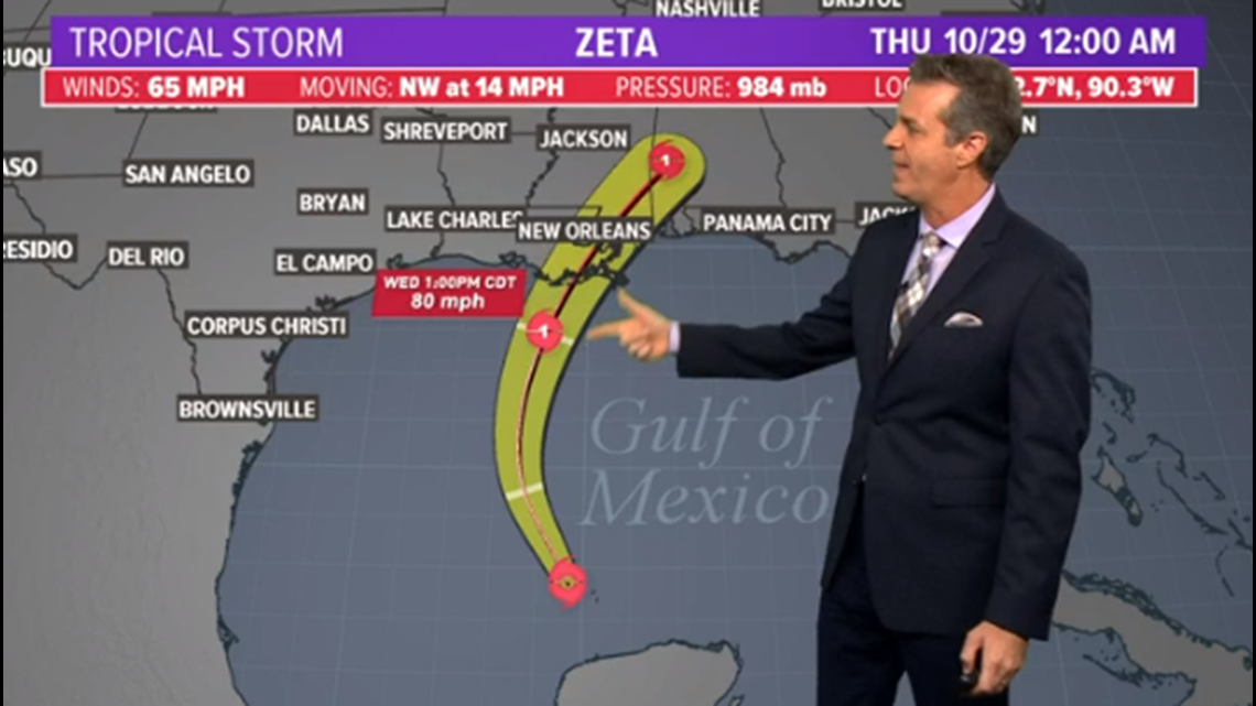
This hurricane will be swept to the east by the front and will be of no consequence to our forecast here in Houston.