
HOUSTON - With feels-like temperatures in the 20s early Tuesday, much of southeast Texas will say "brrrrrr" for the next few days.
A trace amount of snow/sleet was reported Tuesday morning at Bush Intercontinental Airport, breaking the record for earliest observed snow, previously set Nov. 23, 1979, according to the National Weather Service in Houston.
GET ALERTS ON THE GO: Download the KHOU 11 app
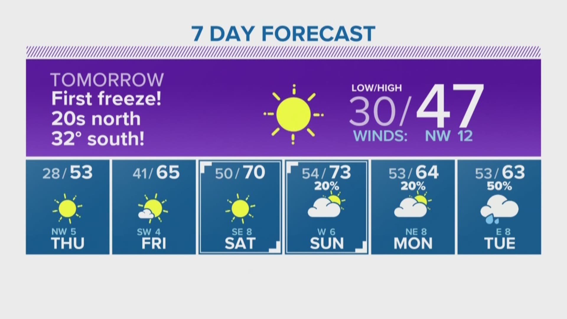
HOUSTON FORECAST: Freeze warning in effect starting late Tuesday night
No icy or dangerous conditions were reported, but areas from Central Texas to as close as Tomball and The Woodlands have reported seeing snow flurries.
A freeze warning has now been issued for the Houston area for overnight Tuesday into Wednesday morning. Dangerous roads are not expected, but you'll want to protect your pets, plants and pipes.
"99 percent of this is evaporating before reaching the ground, but one or two sleet pellets could ping off your windshield this morning as temps hover in the upper-30s north of I-10," tweeted KHOU 11 Meteorologist Brooks Garner.
> What are you seeing in your neighborhood? Email us your weather pics to photos@khou.com, tweet us using #HTownRush or post your weather photos/video on our Facebook page.
Actual temperatures Tuesday morning were in the upper-30's and low-40's across the Houston area, and even colder temperatures are expected in the overnight hours Wednesday and Thursday.
A line of light precipitation moved eastward into areas north of Houston, and by 8 a.m. people started posting their "snow" photos. It's not a blizzard, but after a blazing hot summer you know it doesn't take much snow for us Houstonians to get excited!