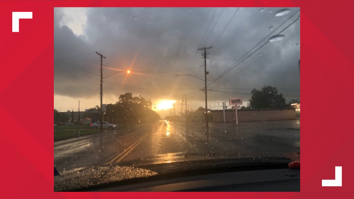
BEAUMONT, Texas — Tropical Depression Imelda continues to inundate Southeast Texas after coming ashore in Freeport, Texas, after forming off the Texas coast at noon Tuesday.
9:14 a.m.: Flash Flood Emergency extended until 1:15 p.m. for Jefferson County, Southwestern Newton County, Southern Hardin County, Orange County and Southeastern Jasper County.
9 a.m.: Jefferson County Judge Jeff Branick Orders Evacuation of Gilbert Lake Estates
7:55 a.m.: All Jefferson County offices will be closed today due to the weather. Non-essential personnel should not to report to work. All essential personnel should contact their supervisor for further instruction and assignment.
All Department of Public Safety offices in Jefferson, Orange, and Chambers Counties will be closed for the entirety of the day. DPS offices in Liberty County will delay opening until 10 a.m.
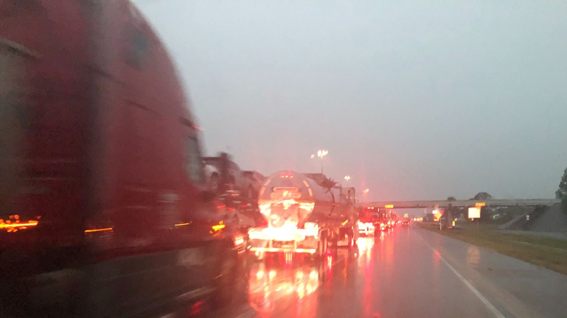
7 a.m.: I-10 is closed in both directions between Winnie and Beaumont
6:30 a.m.: Flash Flood Emergency extended until 9:30 a.m.
6:09 a.m.: Jefferson County has opened two shelters in West Jefferson County at Grace Community Church in LaBelle and 1st Baptist Church in Hamshire.
6 a.m.: We have evacuated our station due to flooding. All employees are safe at a backup facility.
3:15 a.m.: Chambers Co. Sheriff's Office says 911 is overwhelmed; over 1,000 people have asked to be rescued. Air boats, high water vehicles have been deployed. A shelter has been set up at White's Park community building. Pets are accepted...must have a crate or leash. East Chambers High School dome has been set up as a staging area.
2 a.m.: The levels along Pine Island Bayou at Sour Lake and Bevil Oaks took a big jump throughout Imelda's rain.
1:47 a.m.: The National Weather Service has issued a flash flood warning for Northeastern Jefferson County and Orange County until 4:15 a.m.
At 1:45 a.m. doppler radar and automated rain gauges indicated thunderstorms producing heavy rain across the warned area. Between 5 and 10 inches of rain have fallen. Flash flooding is occurring.
Some locations that will experience flooding include Beaumont, Port Arthur, Nederland, Groves, Port Neches, Central Gardens, Port Acres and the Southeast Texas Regional Airport.
Additional rainfall amounts of 2 to 5 inches are possible in the warned area.
1:35 a.m.: The Orange County Office of Emergency Management reports that currently the west end of Orange County is experiencing high levels of rainfall with some roadways being covered with water.
Reports have indicated Hwy 105, Hwy 1131, several roads in Rose City and some roadways in the western parts of the city of Vidor are currently under water.
Use caution when traveling any roadways and use alternate routes when and if possible. SOURCE: Orange County OEM
We're streaming LIVE on YouTube...
1:24 a.m.: The National Weather Service has issued tornado warning for northeastern Jefferson County until 1:45 a.m.
At 1:22 a.m. a severe thunderstorm capable of producing a tornado was located near La Belle, or 9 miles west of Central Gardens, moving northeast at 20 mph.
This dangerous storm will be near Nederland, Central Gardens and Southeast Texas Regional Airport around 1:45 a.m.
12:55 a.m.: The Jefferson County Sheriff's Office reports have had a number of citizens call for assistance in evacuating their homes.
Deputies and your local Volunteer Fire Departments are currently conducting high water rescues ranging from the China/Nome area, all the way over to Highway 73. If a citizen is in need of rescue we ask that they call 911 first.
If 911 is busy and they live in a rural area of Jefferson County call the sheriff's office directly at 409-835-8411.
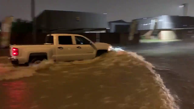
12:46 a.m.: A flash flood emergency has been declared in Beaumont, Port Arthur, Vidor, Rose City and Fannett. Torrential, flooding rainfall occurring with an additional 2 to 5 inches possible over the next few hours.
The Chambers County Emergency Operations center confirms a half-dozen patients along with staff are being evacuated from the Riceland Healthcare hospice facility in Winnie via high water rescue vehicles.
12:38 a.m.: The National Weather Service in Lake Charles has issued a flash flood warning for north central Jefferson County and central Orange County until 2:30 a.m.
At 12:33 a.m. Doppler radar indicated thunderstorms producing heavy rain across the warned area. Five to 10 inches of rain have fallen.
Flash flooding is occurring with reports of evacuations and water rescues within the area.
12:32 a.m. KHOU's Brett Buffington reports that Riceland Hospital in Winnie confirms they are “trying” to evacuate patients because of flooding. The hospital wouldn’t confirm how many patients, or how they are getting out.
The facility is a nursing home/hospital.
======== Wednesday ========
11:50 p.m.: The National Weather Service has issued a tornado warning until 12:30 am for SW Jefferson County including Hamshire. Doppler inidcated the cell is moving northeast at 10 mph.
RELATED: SCHOOLS | Imelda drops several inches of rain forces some school delays, closures in Southeast Texas
11:43 p.m.: The National Weather Service has extended the previous Flash Flood Warning to run through 1:45 a.m. Thursday morning for Jefferson County and Orange County.
11 p.m.: The National Weather Service has issued a tornado warning for SW Jefferson County until 11:45 pm. Moving East at 5 mph along Hwy 73
10:46 p.m. The National Weather Service has issued a Flash Flood Warning through 12:45 a.m. Thursday morning for Northwestern Jefferson County, Southwestern Newton County, Eastern Hardin County, Orange County and Southeastern Jasper County.
8:30 p.m.: Southeast Texas is experiencing street flooding all over, especially in areas and on streets that are prone to flooding.
8:20 p.m.: A few schools in Southeast Texas will be closed or starting late on Thursday morning.
7 p.m.: The National Weather Service has issued a flash flood warning for north Jefferson and south Hardin County until 9 pm. Two inches of rain have fallen in the past hour and more heavy rainfall is expected. Flash flooding could occur shortly.
6:50 p.m.: The Jefferson County Sheriff's Office reports that Highway 365 near Labelle Rd, Spurlock Road underpass at Highway 69 as well as Old Grayburg Road at 326 are all holding water.
The sheriff's office urges drivers to use caution and remember to "turn around, don't drown.
6:30 p.m.: The National Weather Service issued a tornado warning until 7 pm for Chambers County not including Winnie, TX. South of 1H-10 between Anahuac and the interstate
6:05 p.m.: The National Weather Service issued a tornado warning until 6:30 p.m. for Western Chambers County east of Mont Belview. Radar showed healthy rotation with a tornado warned storm near Cove, TX.
5:30 p.m.: A tornado was spotted Wednesday afternoon in Chambers County.
Anthony Garcia shared a video of the tornado moving through a Mont Belvieu around 5:30 p.m.
A photo by KHOU 11 viewer Brian Lockwood showed the small tornado touched down near North Main Street near 1942.
5:30 p.m.: National Weather Service reports a confirmed tornado near Cove @ 5:27 p.m. that will be near Anahuac 5:45 p.m.. The tornado warning for NW Chambers County extneds to 5:45 p.m.
5:23 p.m.: The Jefferson County Office of Emergency Management reports that sandbags will be available for some Jefferson County residents at the Precinct 1 and 3 barns and the Hamshire Volunteer Fire Department.
4:45 p.m.: The Hardin County Sheriff's Office reports that Old Beaumont Road near Sour Lake is closed. Several other roads within Hardin County have water on them but are passable.
The sheriff's office urges drivers to use caution and remember to "turn around, don't drown.
Chambers County 3:30 p.m.: From a Chambers County Emergency Operations center news release...
Tropical Storm Imelda impacted Chambers County with heavy rainfall starting during the evening hours of Tuesday September 17,2019. The County experienced rainfalls averaging 4” – 6” during the overnight hours and into the morning of September 18.
Chambers County EOC was activated and began coordinating damage assessments throughout the county: roads, county buildings and overall conditions county-wide.
Most recent forecast indicates that we can expect an additional 3 – 4” of rainfall throughout the afternoon and evening hours area-wide. That same forecast suggests that we could experience an additional 3 – 10” of rainfall over the span of Thursday – Friday morning. The wide variance is due to the impact of feeder bands, which cannot be forecast.
Please report local conditions to the EOC by emailing: oem@chamberstx.gov
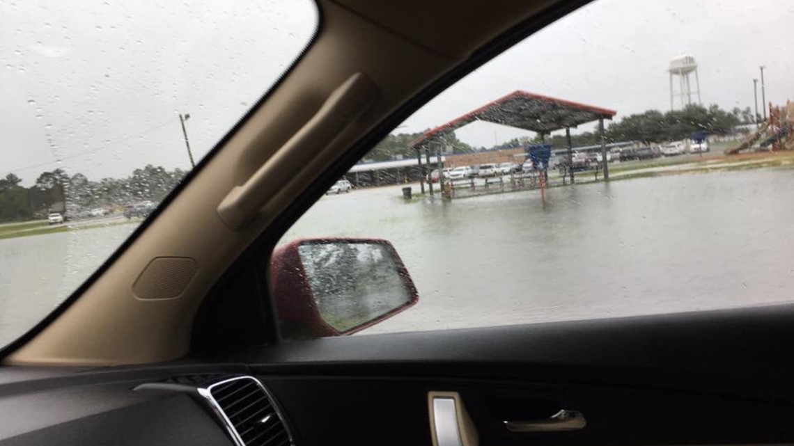
AREA UPDATE: (2:45 p.m.): Rainfall totals in the past 24 hours range from 1-2 inches in the Lakes Area to the Triangle area of Southeast Texas where the range was from 2 – 7 inches.
The soil has become saturated so, additional rainfall will begin to run off. The threat for flash flooding will be increasing tonight and Thursday.
Additional rainfall totals of 4 to 10 inches over the next couple of days are possible which will enhance the flooding potential.
Imelda's remnant center of circulation appears to be over Polk County slowly moving north.
The forecast for the rest of Wednesday afternoon and evening calls for some breaks in the rainfall through about 9 p.m.
However, after that, the rains will ramp up again and it could be heavy. Theses rains may not stop through Thursday.
Friday is looking it will be a wet day with a 70% to 80% rain coverage.
By this weekend, the remnants of Imelda will have dissipated and will have moved north of the area. Hotter, drier weather is expected this weekend.
LATEST ON IMELDA: Imelda dumping heavy rain on Southeast Texas causing number of problems during Wednesday morning commute
SOUR LAKE: Woman spends all morning Wednesday trying to protect her home. (12:43 pm)
SOUR LAKE: Flooding outside of Sour Lake Elementary School; Sandra Cohrs says the area has accumulated more than six inches of rain in less than 48 hours. (10:35 a.m.)

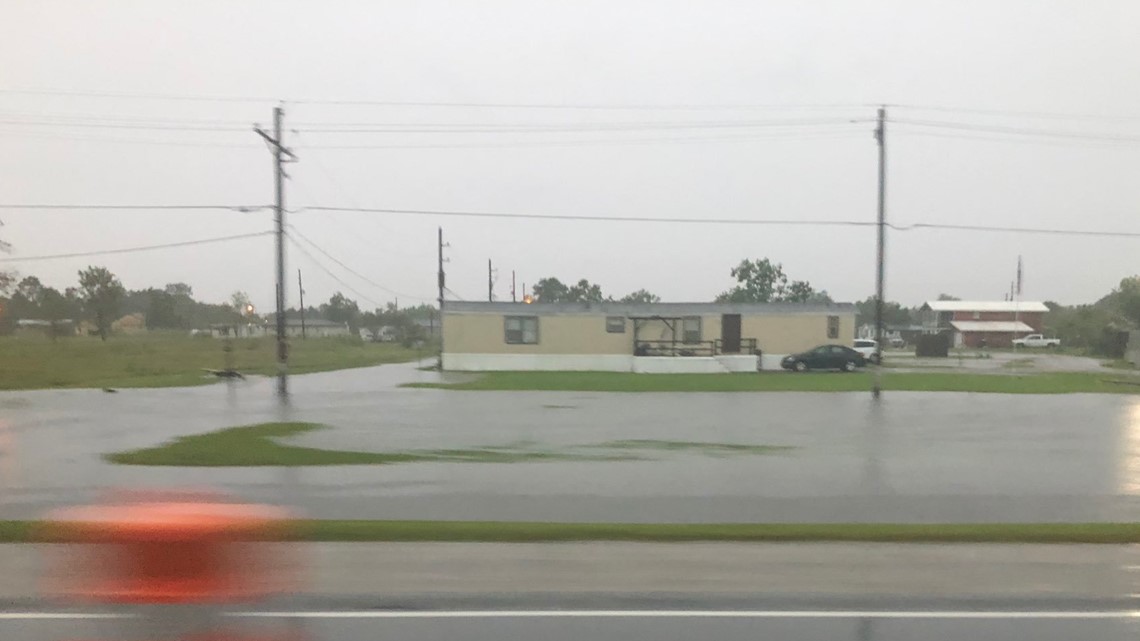
WINNIE: Several yards flooding off Hwy. 73 (10:19 am)
EAST CHAMBERS: Ditches are full outside of East Chambers High in Winnie; All East Chambers ISD schools are closed ... Rachel Keller says "very little cars on the road" (10:13 am)
WINNIE: Rachel Keller is reporting that heavy rain is falling; ditches along Buccaneer Dr. are starting to fill up. (10:05 am)
SOUR LAKE: Reports of homes flooding on Old Beaumont Rd., according to Sarah Harrington on Facebook; says she has 6 inches of rain in her gauge (9:40 am)
SPURGER: Heavy rain for several hours now (9:37 am)
FANNETT: Street flooding reported in Fannett in western Jefferson County.
PORT ARTHUR: Slow moving traffic coming from Beaumont to Port Arthur on Hwy 69 around Fannett Rd. Michelle says: "Be safe coming around that curve from I-10 to 69 south" (8 am)
BEAUMONT: Ponding reported on service road @ I-10 and College St.; our crews on the road report seeing several cars spinning out due to the slick conditions. BPD has worked seven major accidents since 6 a.m. (7:55 am)
JEFFERSON COUNTY: Water is starting to get high in yards off Hwy 124 and 265. (7:49 am)
WINNIE: I-10 east closed down east of Winnie; many of the ditches are full and there is minor flooding in some yards (7:40 am)


ORANGE: Only light rain reported; a mix of rain, sun & clouds during the morning commute (7:27 am)

PORT ARTHUR: Several viewers have mentioned heavy rain falling across Port Arthur (7:05 am)
SILSBEE: Heavy down pours reported in Silsbee (7:05 am)
SOUR LAKE: Many ditches are already full (7:10 am)
BEAUMONT: Ponding on Eastex Fwy between Education First Federal Credit Union and Parkdale Mall (6:30 am)
CHINA: 5 inches of rain reported there overnight (6:24 am)
SCHOOL CLOSURES: Tropical Storm Imelda: School closures in Southeast Texas