
MIAMI — Tropical Storm Eta made another landfall on Lower Matecumbe Key, Florida late Sunday night, bringing street flooding to the area.
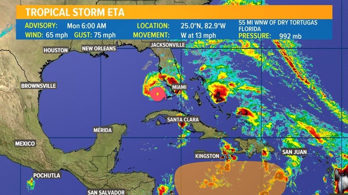
As of the 7 a.m. Central update from the National Hurricane Center on Monday, the storm has winds of 65 mph and is moving west-northwest at 13 mph.
See Eta's forecast cone and spaghetti models in the images at the bottom of this article
A tropical storm warning is in effect for the Florida Coast from north Englewood to Anna Maria Island, coastal and inland Manatee County, DeSoto, Hardee, Highlands, and coastal and inland Sarasota County. The hurricane warning for the Florida Keys and Florida Bay has been replaced with a tropical storm warning.
Where is Eta heading?
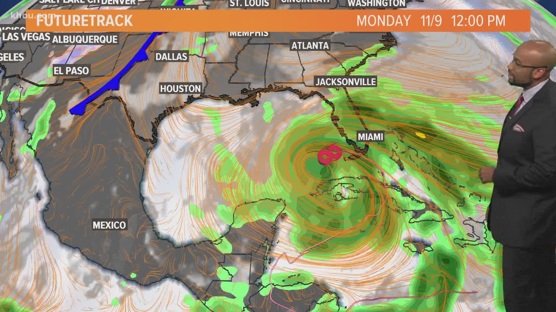
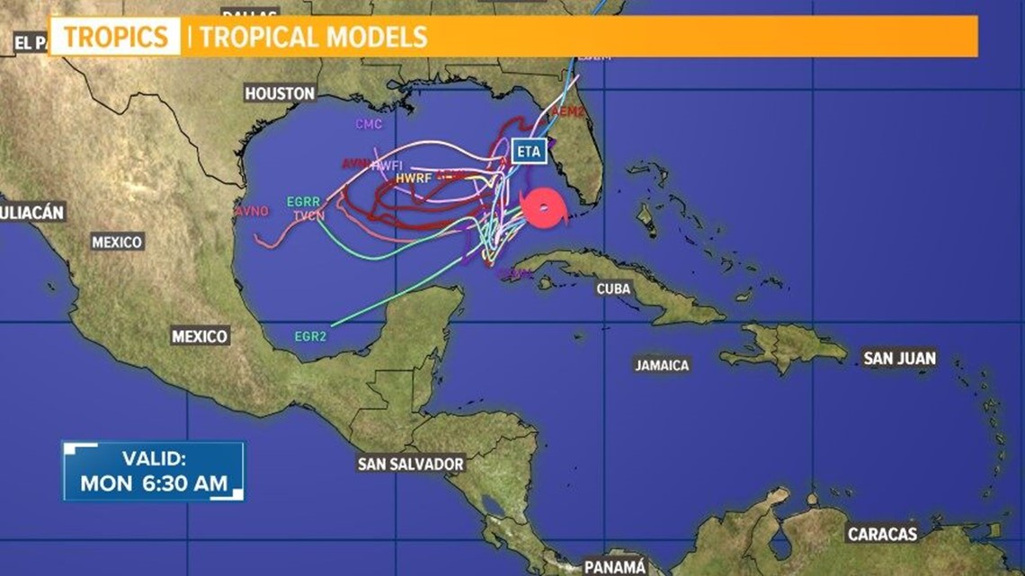
The next move for the storm will be to head into the southeast Gulf of Mexico Monday in the afternoon hours into Tuesday. There remains significant uncertainty in the long-range forecast of the track and intensity, but it is not expected to be a problem for the Houston area or the rest of the Texas coast.
More storms after Eta?
That's right - we may be setting a new record:
Tropical Storm Eta position and strength

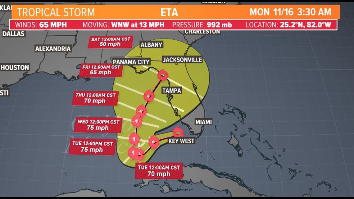
Tropical Storm Eta forecast cone

Tropical Storm Eta spaghetti models

Tracking Tropical Storm Eta - interactive map
Key messages for Tropical Storm Eta from National Hurricane Center 7 a.m. Monday
1. Heavy rainfall from Eta will continue across portions of Cuba, Jamaica, the Bahamas, and southern Florida and spread north into central Florida. Life-threatening flash flooding will be possible across inundated urban areas of southeast Florida today. Flash and urban flooding will also be possible for Cuba, Jamaica, the Bahamas and the remainder of southern Florida, along with potential minor river flooding in central Florida.
2. Tropical storm conditions will continue across portions of the Florida Keys, and south and central Florida today.
3. Water levels will gradually recede along portions of the southern coast of the Florida peninsula and Keys. Residents in these areas should follow any advice given by local officials.
4. Eta could approach the Florida Gulf Coast later this week as a tropical storm, and possibly bring impacts from rain, wind, and storm surge. Interests in this area should monitor the progress of Eta and updates to the forecast this week.