
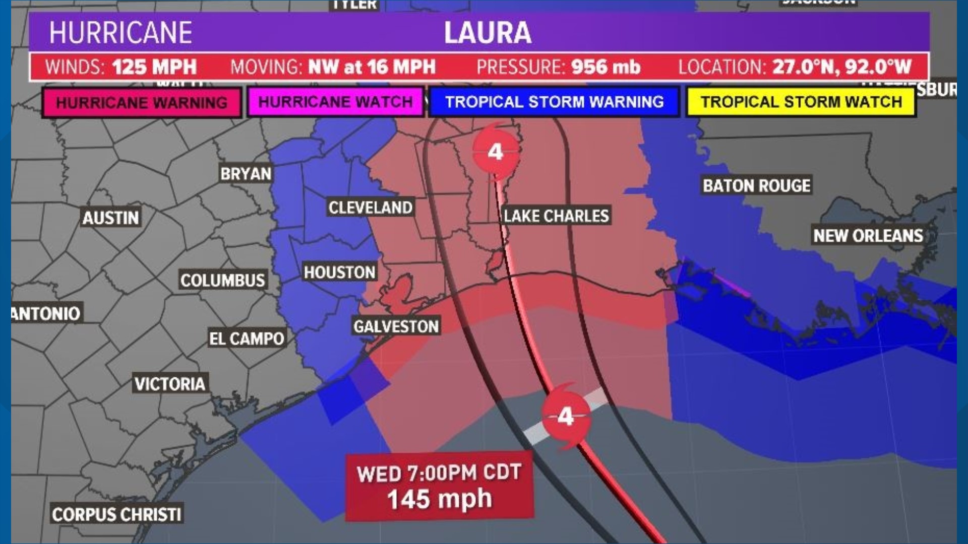
HOUSTON — Hurricane Laura has become an "extremely dangerous" Category 4 storm as it takes aim at the Texas, Louisiana borders.
Hurricane Laura’s chances of having a shift in its path -- closer to Houston -- are looking less and less likely.
Landfall is expected between midnight and 3 a.m. Thursday.
There is higher confidence in the forecast data the various computer models use and nearly all the models (the "spaghetti plots," so to speak) are within the official National Hurricane Center’s forecast cone.
There is one exception, but it is just outside the western edge of the cone.
Thankfully, there have been little to no changes with the cone over the past several official updates from the National Hurricane Center.
Much of the Houston area is outside the forecast cone, with the exception of extreme eastern Liberty and Chambers counties.
Why Hurricane Laura should stay on its path
The reason we are highly unlikely to see a sudden change of course for Laura is because the steering winds aloft will be holding steady, as the Bermuda High pressure system will be sitting over Georgia and barely moving.
If it were to shift a touch westward, it would push Laura closer to Houston, but that isn’t the case going forward.