
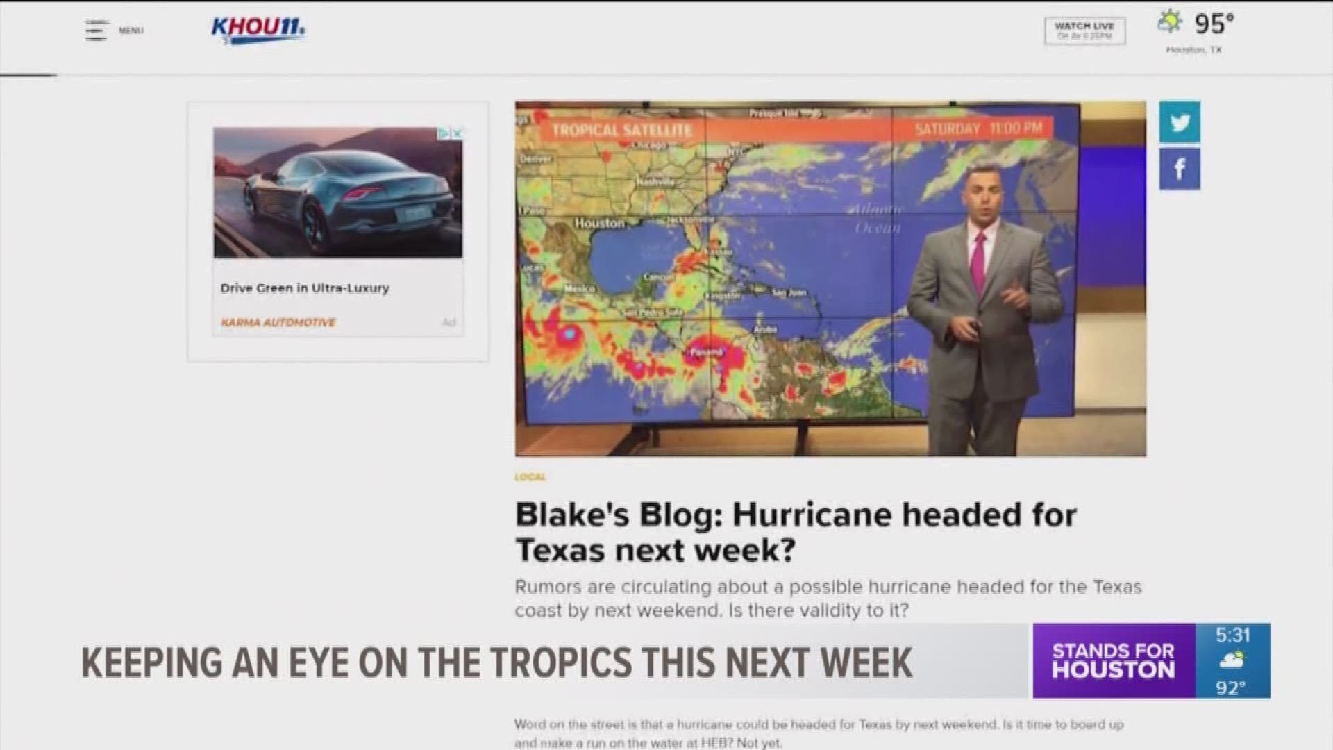
HOUSTON — Word on the street is that a hurricane could be headed for Texas by next weekend. Is it time to board up and make a run on the water at HEB? Not yet.
While it is true that some models do show a tropical storm or hurricane headed for the Texas coast by next weekend, the rumor needs context and explaining.

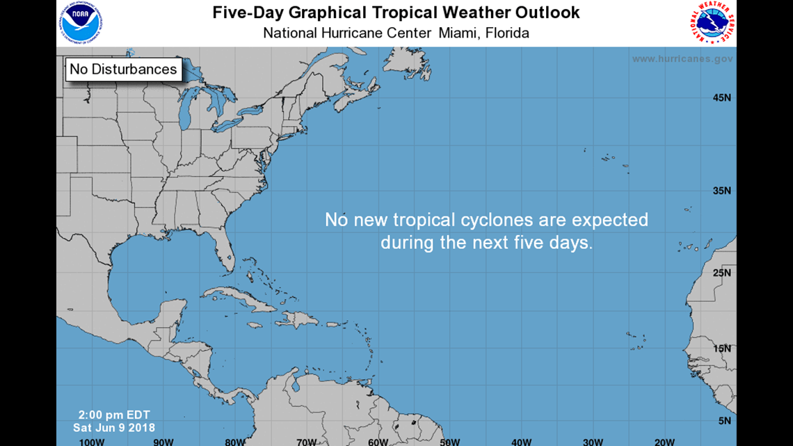
First, the National Hurricane Center continues to suggest that there is no chance of development in the Gulf of Mexico for at least the next five days. The National Weather Service here in Houston also echoed the same sentiment in Saturday's afternoon forecast discussion:
"to quell any further rumors about the tropics, there is still a single model -- one of many meteorologists use daily -- that is suggesting tropical development next weekend. This single model has a reputation for developing these significant weather systems in the 7-14 day forecast in all seasons, a majority of which do not come to fruition. To echo my colleague from the discussion earlier today, models are generally less accurate the farther out in time you go. Please continue to keep up to date with the latest forecast from the National Hurricane Center."
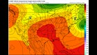
That said, I have to respectfully disagree with the National Weather Service. There is more than one model that shows development in the Gulf of Mexico. They include: the GFS (American model), CMC (Canadian model), NAVGEM and ICON models. Granted, they're not the gold standard in tropical forecasting either.
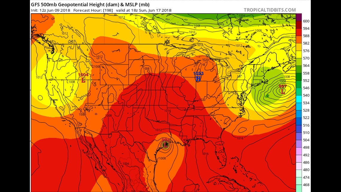
On the flip side, the European model, the Cadillac of atmospheric prognositication, doesn't show a single blip of anything developing in the gulf through 240 hours (10 days). I'm inclined to believe the Euro -- for now.
Hurricanes hitting Texas in June isn't unheard of but it certainly isn't a common occurrence. In fact the last time it happened was back in June of 1986 when Bonnie made landfall near Beaumont as a category one hurricane -- 32 years ago. Looking back all the way to 1900, only six hurricanes have hit the state in June, seven if you include Hurricane Audrey that technically made landfall in extreme southwest Louisiana in 1957 but still brought hurricane conditions to east Texas.
Development Chances:
Over the next seven days, conditions in the Gulf of Mexico appear to be marginal to decent for tropical development. Very strong wind shear currently ripping over the gulf is forecast to relax dramatically by next weekend. That coupled with very warm, 30°C water (86°F) should be help any organizing system should thunderstorms try to become organized.
The other key to development is the MJO or Madden-Julian Oscillation. The MJO is an eastward propagating wave or pulse of rain and clouds that can help the genesis or birth of cyclones. When the MJO moves into either phase 8, 1 or 2, it can mean very advantageous conditions for any developing system. Next week, the MJO is forecast to move into phase 1 and 2 as seen in the tweet above from meteorologist Joe Bastardi.
Where would it go if it developed?
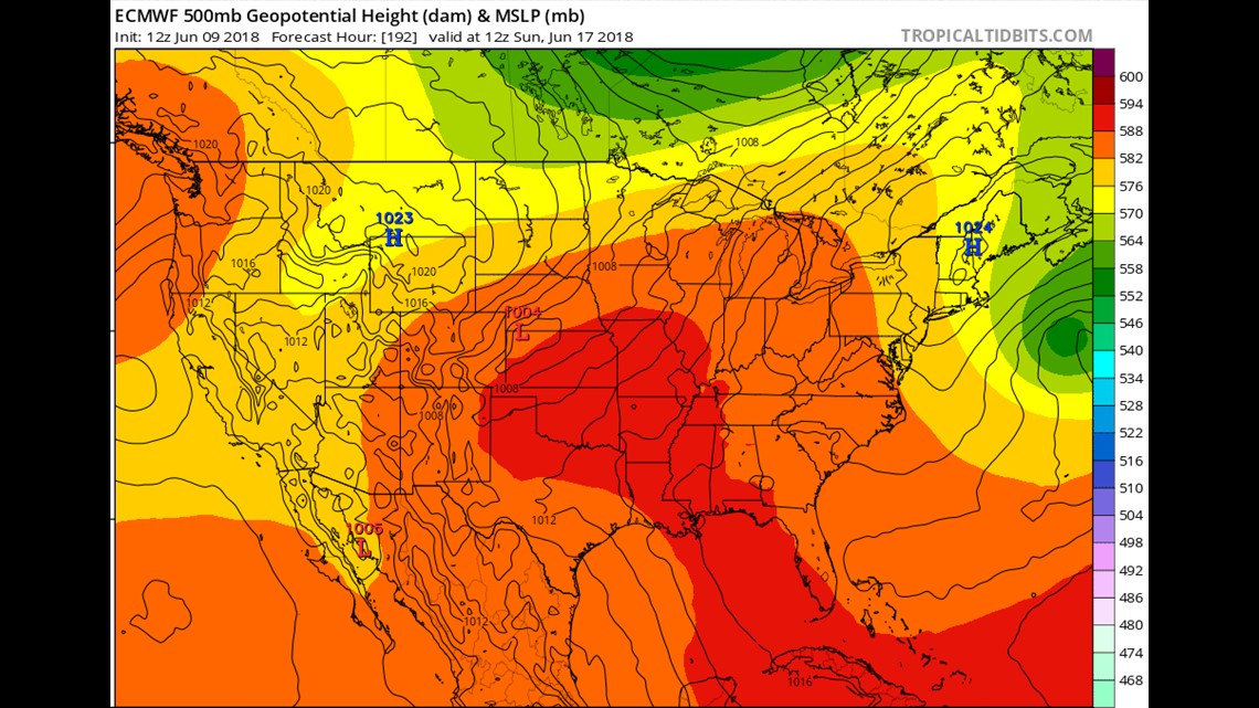
Currently it's just too soon to know. It's hard to track a system that only exists on a computer in the far extended range. The current set up would favor a northern gulf coast or northwest gulf coast impact area thanks to a ridge of high pressure developing over Florida and one over Mexico and west Texas. These highs act as atmospheric brick walls. Therefore the only place a system could go is between them which would be the Texas or Louisiana coast.
That said, there is nothing in the gulf currently and there is no immediate threat AT ALL. Therefore just keep checking back in once a day to get the latest on any possible tropical situation.
Important Takeaways:
1. Nobody is saying a hurricane is coming for Texas. We're just saying we're monitoring the models, some of which suggest a storm is possible.
2. Some of the better computer models don't show any type of development at all. None.
3. Models will continue to shift wildly over the next few days showing potential landfall points all over the gulf coast from Florida to Brownsville more than likely.
4. A storm may not form at all.
You can keep up to date with KHOU through every platform available whether it be through twitter, facebook, instagram or on-air. We encourage you to check back with us once a day just to make sure everything remains kosher.
Like my blog? Please follow me on Twitter HERE.
-Meteorologist Blake Mathews