
HOUSTON — For tips on how to prepare for hurricane season, including downloading Evacuation Route and Zip Zone Maps, log on to h-gac.com.
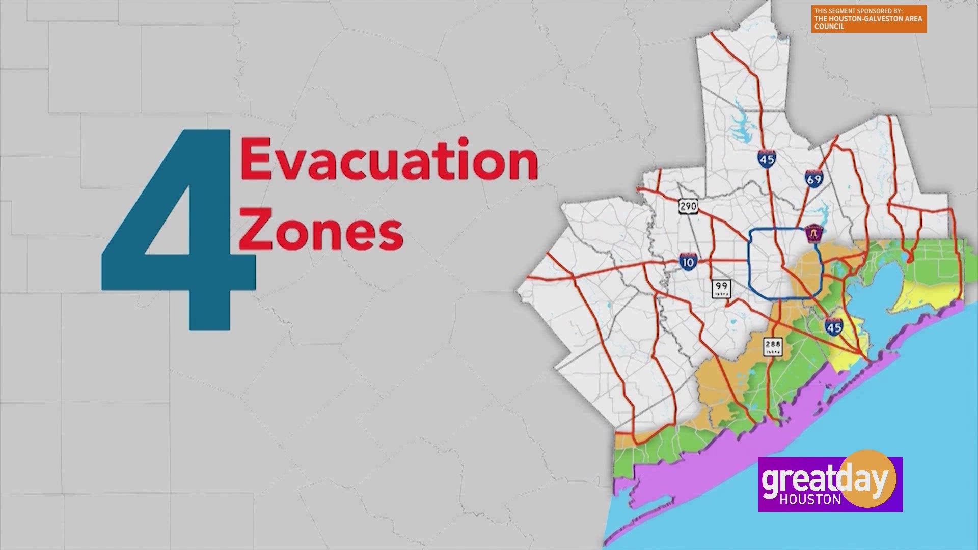
If it becomes necessary to evacuate residents during a hurricane, authorities will issue evacuation orders in a phased approach by zip code zone or "zip zone." Coastal residents should become familiar with which zip zone they reside in. Knowing your zone will help you better understand when and if you need to evacuate during a hurricane. It will also help you avoid unnecessary evacuation travel, thereby reducing highway congestion, easing overcrowding at local storm shelters, and boosting public safety.
Hurricane evacuation routes are specially designated roadways used to provide the safest and most timely evacuation of coastal areas during a hurricane threat. Once you are familiar with your zip zone, it's important to know the evacuation routes near you. Download and save a copy of our evacuation route map to help plan your route.
Residents who live outside the hurricane evacuation zones should be prepared to shelter in place in the event of a severe storm. Prepare an emergency supply kit with enough non-perishable food and water for at least three days. If you have pets or large animals in your care, plan to have enough food to last them for several days. Also, plan for relatives with medical or special needs.
Houston-Galveston Area Council is on Facebook, Twitter, LinkedIn, Instagram, and YouTube @HouGalvAreaCog.
This content sponsored by The Houston-Galveston Area Council