NOTE: This page will no longer be updated. We're now updating coverage of the Tropical Storm Ida here.
__________________________________
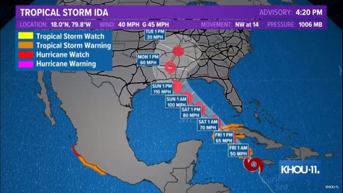
What was Tropical Depression 9 has strengthened to become Tropical Storm Ida. The National Hurricane Center has the storm intensifying more into a hurricane once it makes it into the Gulf of Mexico.
The NHC said in their 4 p.m. advisory that they expect the system to approach the Gulf Coast on Sunday.
As of the 4 p.m. Central update Thursday, the forecast cone is centered on Louisiana with Texas being mostly left out:

Atmospheric conditions are favorable for development. The next two storm names on the Atlantic list are Ida and Julian, and this system could be named later today.`
It is trending west-northwest through the Caribbean. The overall track, intensity and final landfall remain uncertain, but it's looking likely that it will be a hurricane.
"Intensity forecast suggests this could become a major hurricane (Cat 3 or higher) at landfall," tweeted KHOU 11 Chief Meteorologist David Paul.
Models are having a tough time understanding where this moisture is going to travel because it is hasn't developed yet. But the overall thinking as it moves west it will near the Gulf this weekend.
Many of the forecast models this morning centered for somewhere along the Louisiana or upper Texas coast, but it's too soon to know for sure. We'll keep you updated.
Thursday afternoon spaghetti models

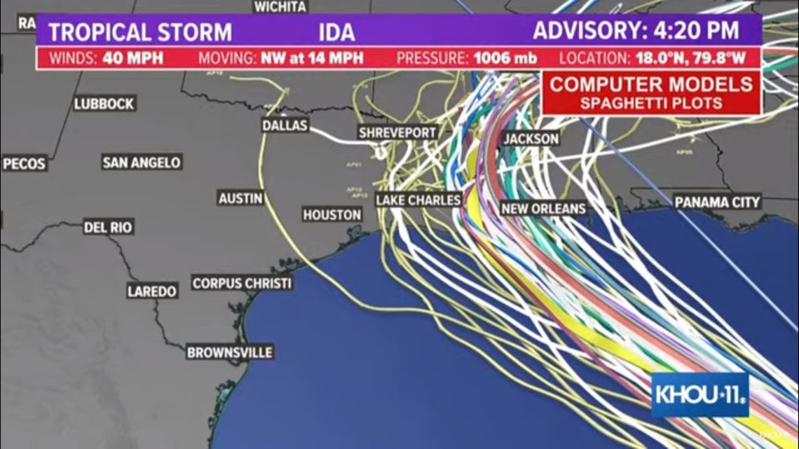
In general, you can see the track go across the northwest Caribbean into the Gulf of Mexico and possibly impacting the Texas and Louisiana coast, but there’s still a lot of uncertainty.
National Hurricane Center messaging — 4 p.m. Thursday:
1. Tropical storm conditions are expected in portions of the Cayman
Islands tonight and in portions of western Cuba and the Isle of
Youth Friday. Dangerous storm surge is possible Friday in portions
of western Cuba, including the Isle of Youth, in areas of onshore
flow.
2. Life-threatening heavy rains, flash flooding and mudslides are
expected across Jamaica, the Cayman Islands, and western Cuba,
including the Isle of Youth.
3. The system is forecast to approach the northern Gulf coast at or
near major hurricane intensity on Sunday, where there is an
increasing risk of life-threatening storm surge, damaging
hurricane-force winds, and heavy rainfall Sunday and Monday,
especially along the coast of Louisiana. Storm Surge and Hurricane
watches will likely be issued for a portion of this area later
tonight or Friday morning. Interests in these areas should closely
monitor the progress of this system and follow any advice given by
local officials.